Ciladaeun geodata
Ciladaeun (Banten) is a seat of a fourth-order administrative division; located in Indonesia in Asia/Jakarta (GMT+7) time zone. In our database, there are 407 cities with bigger population. Compared to other cities in Indonesia, 82.3% of cities are located further ↓South; 87.8% of cities are located further →East and 76.2% of cities have lower elevation than Ciladaeun. Note1


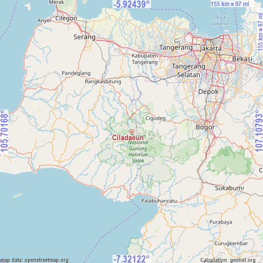
Ciladaeun GPS coordinates[2]
6° 37' 23.88" South, 106° 24' 17.28" East
| Map corner | latitude | longitude |
|---|---|---|
| Upper-left | -5.92439°, | 105.70168° |
| Center: | -6.6233°, | 106.4048° |
| Lower-right: | -7.32122°, | 107.10793° |
| Map W x H: | 155.3×155.3 km | = 96.5×96.5mi |
| max Lat: | 5.88969° ⇑17.7% North |
| Ciladaeun: | -6.6233° |
| min Lat: | ⇓82.3% South -10.934° |
| min Long | Ciladaeun | max Long |
| 95.1345° | 106.4048° | 140.9419° |
| W 12.2%⇐ | ⇒87.8% E |
Elevation
Elevation of Ciladaeun is 376 m = 1234 ft, and this is 146.3 m = 480 ft above average elevation for this country.
| Max E: |
3185 m = 10449 ft | 23.8% |
| Ciladaeun | 376 m 1234 ft | |
| Avg. | 229.7 m = 754 ft | |
Min E: |
-1 m = -3 ft | 76.2% |
See also: Indonesia elevation on elevation.city.
Geographical zone
Ciladaeun is located in South Torrid zone (between Equator and Tropic of Capricorn). Distance of Equator is 736.4 km =457.6 mi to North.| Distance of | km | miles | from Ciladaeun |
|---|---|---|---|
| Equator | 736.4 | 457.6 | to North |
| Tropic Capricorn | 1869.5 | 1161.7 | to South |
| Antarctic Circle | 6664.7 | 4141.3 | to South |
| South Pole | 9270.6 | 5760.5 | to South |


Nearby cities:
15 places around Ciladaeun: (largest is in red/bold)
• Bojongsarung
2 km =1.2 mi,  272°
272°
• Cigebrok
7.4 km =4.6 mi,  330°
330°
• Cikarae
7.7 km =4.8 mi,  340°
340°
• Cikomara
6.2 km =3.9 mi,  7°
7°
• Cikuning
8.5 km =5.3 mi,  238°
238°
• Cileuksa
5 km =3.1 mi,  63°
63°
• Cipanas
8.2 km =5.1 mi,  355°
355°
• Ciparasi
7.9 km =4.9 mi, 238°
• Cisarua
8 km =5 mi,  114°
114°
• Gunungjulang
1.6 km =1 mi,  126°
126°
• Jaha
4.1 km =2.5 mi, 9°
• Maja
5.8 km =3.6 mi,  231°
231°
• Padurung
4.3 km =2.7 mi, 338°
• Pasirmadang
8.6 km =5.3 mi,  71°
71°
• Puputan
8.7 km =5.4 mi, 325°
Sources, notices
• [Note1] Compared only with cities in Indonesia existing in our database
• [Src1] Map data: © OpenStreetMap contributors (CC-BY-SA)
• [Src2] Other city data from geonames.org with taken over terms of usage.
• [Src3] Geographical zone / Annual Mean Temperature by Robert A. Rohde @ Wikipedia
