Jaha geodata
Jaha (Banten) is a seat of a fourth-order administrative division; located in Indonesia in Asia/Jakarta (GMT+7) time zone. In our database, there are 407 cities with bigger population. Compared to other cities in Indonesia, 82.9% of cities are located further ↓South; 87.8% of cities are located further →East and 74.1% of cities have lower elevation than Jaha. Note1


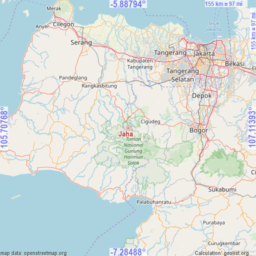
Jaha GPS coordinates[2]
6° 35' 12.84" South, 106° 24' 38.88" East
| Map corner | latitude | longitude |
|---|---|---|
| Upper-left | -5.88794°, | 105.70768° |
| Center: | -6.5869°, | 106.4108° |
| Lower-right: | -7.28488°, | 107.11393° |
| Map W x H: | 155.3×155.3 km | = 96.5×96.5mi |
| max Lat: | 5.88969° ⇑17.1% North |
| Jaha: | -6.5869° |
| min Lat: | ⇓82.9% South -10.934° |
| min Long | Jaha | max Long |
| 95.1345° | 106.4108° | 140.9419° |
| W 12.2%⇐ | ⇒87.8% E |
Elevation
Elevation of Jaha is 347 m = 1138 ft, and this is 117.3 m = 385 ft above average elevation for this country.
| Max E: |
3185 m = 10449 ft | 25.9% |
| Jaha | 347 m 1138 ft | |
| Avg. | 229.7 m = 754 ft | |
Min E: |
-1 m = -3 ft | 74.1% |
See also: Indonesia elevation on elevation.city.
Geographical zone
Jaha is located in South Torrid zone (between Equator and Tropic of Capricorn). Distance of Equator is 732.4 km =455.1 mi to North.| Distance of | km | miles | from Jaha |
|---|---|---|---|
| Equator | 732.4 | 455.1 | to North |
| Tropic Capricorn | 1873.5 | 1164.1 | to South |
| Antarctic Circle | 6668.8 | 4143.8 | to South |
| South Pole | 9274.7 | 5763 | to South |


Nearby cities:
15 places around Jaha: (largest is in red/bold)
• Bojongsarung
4.7 km =2.9 mi,  213°
213°
• Cigebrok
4.9 km =3 mi,  298°
298°
• Cikarae
4.6 km =2.9 mi,  315°
315°
• Cikomara
2.1 km =1.3 mi,  2°
2°
• Ciladaeun
4.1 km =2.5 mi,  189°
189°
• Cileuksa
4.2 km =2.6 mi,  115°
115°
• Cimarkum
7.4 km =4.6 mi,  290°
290°
• Cipanas
4.4 km =2.7 mi,  341°
341°
• Gajrug
7.5 km =4.7 mi,  332°
332°
• Gunungjulang
5 km =3.1 mi,  173°
173°
• Hamberang Sabrang
5.5 km =3.4 mi,  351°
351°
• Lurah
6.6 km =4.1 mi, 335°
• Padurung
2.3 km =1.4 mi,  269°
269°
• Puputan
6.4 km =4 mi, 299°
• Sukamaju
6.7 km =4.2 mi, 339°
Sources, notices
• [Note1] Compared only with cities in Indonesia existing in our database
• [Src1] Map data: © OpenStreetMap contributors (CC-BY-SA)
• [Src2] Other city data from geonames.org with taken over terms of usage.
• [Src3] Geographical zone / Annual Mean Temperature by Robert A. Rohde @ Wikipedia
