Sarampu geodata
Sarampu (Banten) is a seat of a fourth-order administrative division; located in Indonesia in Asia/Jakarta (GMT+7) time zone. In our database, there are 407 cities with bigger population. Compared to other cities in Indonesia, 85.9% of cities are located further ↓South; 92.8% of cities are located further →East and 59.1% of cities have higher elevation than Sarampu. Note1


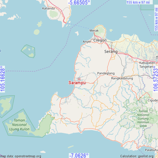
Sarampu GPS coordinates[2]
6° 21' 51.48" South, 105° 52' 9.84" East
| Map corner | latitude | longitude |
|---|---|---|
| Upper-left | -5.66505°, | 105.16628° |
| Center: | -6.3643°, | 105.8694° |
| Lower-right: | -7.0626°, | 106.57253° |
| Map W x H: | 155.4×155.4 km | = 96.6×96.6mi |
| max Lat: | 5.88969° ⇑14.1% North |
| Sarampu: | -6.3643° |
| min Lat: | ⇓85.9% South -10.934° |
| min Long | Sarampu | max Long |
| 95.1345° | 105.8694° | 140.9419° |
| W 7.2%⇐ | ⇒92.8% E |
Elevation
Elevation of Sarampu is 63 m = 207 ft, and this is 166.7 m = 547 ft below average elevation for this country.
| Max E: |
3185 m = 10449 ft | 59.1% |
| Avg. | 229.7 m = 754 ft | |
| Sarampu | 63 m = 207 ft | |
Min E: |
-1 m = -3 ft | 40.9% |
See also: Indonesia elevation on elevation.city.
Geographical zone
Sarampu is located in South Torrid zone (between Equator and Tropic of Capricorn). Distance of Equator is 707.6 km =439.7 mi to North.| Distance of | km | miles | from Sarampu |
|---|---|---|---|
| Equator | 707.6 | 439.7 | to North |
| Tropic Capricorn | 1898.3 | 1179.5 | to South |
| Antarctic Circle | 6693.5 | 4159.1 | to South |
| South Pole | 9299.4 | 5778.4 | to South |


Nearby cities:
15 places around Sarampu: (largest is in red/bold)
• Badur
3 km =1.9 mi,  233°
233°
• Bangko Dua
3 km =1.9 mi,  143°
143°
• Banyuresmi
1.5 km =0.9 mi,  52°
52°
• Jami
1.5 km =0.9 mi,  106°
106°
• Kadubadak
3 km =1.9 mi,  176°
176°
• Kaducondong
2.5 km =1.6 mi,  320°
320°
• Kadukotok
2.5 km =1.6 mi,  71°
71°
• Padahayu
1.3 km =0.8 mi, 226°
• Pamarayan
3.4 km =2.1 mi, 73°
• Parigi
2.1 km =1.3 mi,  160°
160°
• Picungbera
3 km =1.9 mi,  293°
293°
• Sepenmasjid
2.5 km =1.6 mi,  260°
260°
• Sukacai
1.8 km =1.1 mi,  350°
350°
• Sukacai Tengah
1.5 km =0.9 mi,  341°
341°
• Tenjolahang Timur
1.8 km =1.1 mi,  303°
303°
Sources, notices
• [Note1] Compared only with cities in Indonesia existing in our database
• [Src1] Map data: © OpenStreetMap contributors (CC-BY-SA)
• [Src2] Other city data from geonames.org with taken over terms of usage.
• [Src3] Geographical zone / Annual Mean Temperature by Robert A. Rohde @ Wikipedia
