Gunungputri geodata
Gunungputri (Banten) is a seat of a fourth-order administrative division; located in Indonesia in Asia/Jakarta (GMT+7) time zone. In our database, there are 407 cities with bigger population. Compared to other cities in Indonesia, 86% of cities are located further ↓South; 89.6% of cities are located further →East and 55% of cities have lower elevation than Gunungputri. Note1


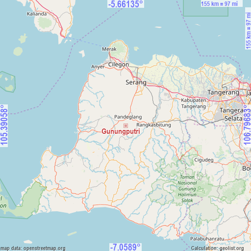
Gunungputri GPS coordinates[2]
6° 21' 38.16" South, 106° 5' 37.32" East
| Map corner | latitude | longitude |
|---|---|---|
| Upper-left | -5.66135°, | 105.39058° |
| Center: | -6.3606°, | 106.0937° |
| Lower-right: | -7.0589°, | 106.79683° |
| Map W x H: | 155.4×155.4 km | = 96.6×96.6mi |
| max Lat: | 5.88969° ⇑14% North |
| Gunungputri: | -6.3606° |
| min Lat: | ⇓86% South -10.934° |
| min Long | Gunungputri | max Long |
| 95.1345° | 106.0937° | 140.9419° |
| W 10.4%⇐ | ⇒89.6% E |
Elevation
Elevation of Gunungputri is 125 m = 410 ft, and this is 104.7 m = 344 ft below average elevation for this country.
| Max E: |
3185 m = 10449 ft | 45% |
| Avg. | 229.7 m = 754 ft | |
| Gunungputri | 125 m = 410 ft | |
Min E: |
-1 m = -3 ft | 55% |
See also: Indonesia elevation on elevation.city.
Geographical zone
Gunungputri is located in South Torrid zone (between Equator and Tropic of Capricorn). Distance of Equator is 707.2 km =439.4 mi to North.| Distance of | km | miles | from Gunungputri |
|---|---|---|---|
| Equator | 707.2 | 439.4 | to North |
| Tropic Capricorn | 1898.7 | 1179.8 | to South |
| Antarctic Circle | 6693.9 | 4159.4 | to South |
| South Pole | 9299.8 | 5778.6 | to South |


Nearby cities:
15 places around Gunungputri: (largest is in red/bold)
• Babakan
2.4 km =1.5 mi,  293°
293°
• Cibebek
2.8 km =1.7 mi,  318°
318°
• Cibogo
3.6 km =2.2 mi,  123°
123°
• Cikeper
3.7 km =2.3 mi,  167°
167°
• Cileuksa
1.6 km =1 mi,  207°
207°
• Citalahab
1.9 km =1.2 mi,  150°
150°
• Curuggaru
3.5 km =2.2 mi,  301°
301°
• Garawati
2.8 km =1.7 mi,  96°
96°
• Kadubincarung
1.9 km =1.2 mi,  60°
60°
• Kadugedong
0.8 km =0.5 mi, 117°
• Majamasjid
3.5 km =2.2 mi,  358°
358°
• Penikebon
2.2 km =1.4 mi,  341°
341°
• Rancapiit
0.9 km =0.6 mi,  202°
202°
• Salinggara
1.6 km =1 mi,  257°
257°
• Sidamulya Satu
2.9 km =1.8 mi, 200°
Sources, notices
• [Note1] Compared only with cities in Indonesia existing in our database
• [Src1] Map data: © OpenStreetMap contributors (CC-BY-SA)
• [Src2] Other city data from geonames.org with taken over terms of usage.
• [Src3] Geographical zone / Annual Mean Temperature by Robert A. Rohde @ Wikipedia
