Curuggaru geodata
Curuggaru (Banten) is a seat of a fourth-order administrative division; located in Indonesia in Asia/Jakarta (GMT+7) time zone. In our database, there are 407 cities with bigger population. Compared to other cities in Indonesia, 86.3% of cities are located further ↓South; 90.1% of cities are located further →East and 63.2% of cities have lower elevation than Curuggaru. Note1


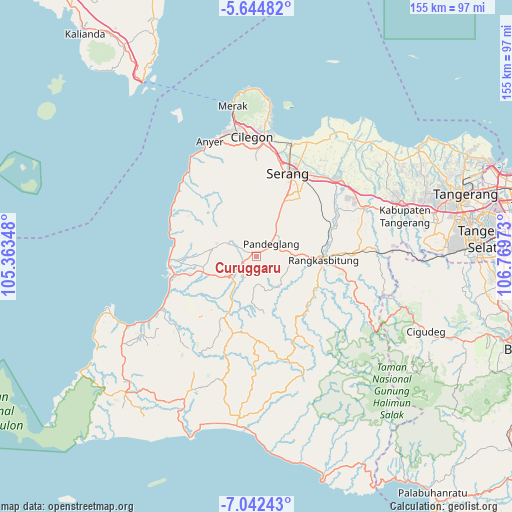
Curuggaru GPS coordinates[2]
6° 20' 38.76" South, 106° 3' 59.76" East
| Map corner | latitude | longitude |
|---|---|---|
| Upper-left | -5.64482°, | 105.36348° |
| Center: | -6.3441°, | 106.0666° |
| Lower-right: | -7.04243°, | 106.76973° |
| Map W x H: | 155.4×155.4 km | = 96.6×96.6mi |
| max Lat: | 5.88969° ⇑13.7% North |
| Curuggaru: | -6.3441° |
| min Lat: | ⇓86.3% South -10.934° |
| min Long | Curuggaru | max Long |
| 95.1345° | 106.0666° | 140.9419° |
| W 9.9%⇐ | ⇒90.1% E |
Elevation
Elevation of Curuggaru is 199 m = 653 ft, and this is 30.7 m = 101 ft below average elevation for this country.
| Max E: |
3185 m = 10449 ft | 36.8% |
| Avg. | 229.7 m = 754 ft | |
| Curuggaru | 199 m = 653 ft | |
Min E: |
-1 m = -3 ft | 63.2% |
See also: Indonesia elevation on elevation.city.
Geographical zone
Curuggaru is located in South Torrid zone (between Equator and Tropic of Capricorn). Distance of Equator is 705.4 km =438.3 mi to North.| Distance of | km | miles | from Curuggaru |
|---|---|---|---|
| Equator | 705.4 | 438.3 | to North |
| Tropic Capricorn | 1900.5 | 1180.9 | to South |
| Antarctic Circle | 6695.8 | 4160.6 | to South |
| South Pole | 9301.7 | 5779.8 | to South |


Nearby cities:
15 places around Curuggaru: (largest is in red/bold)
• Babakan
1.2 km =0.7 mi,  138°
138°
• Batubantar
2.5 km =1.6 mi,  254°
254°
• Cibebek
1.2 km =0.7 mi,  75°
75°
• Cilanggar
3.1 km =1.9 mi,  295°
295°
• Cipacung Landeuh
2.4 km =1.5 mi,  46°
46°
• Girihieum
1.4 km =0.9 mi,  11°
11°
• Gunungputri
3.5 km =2.2 mi,  121°
121°
• Kalahang
2.4 km =1.5 mi,  219°
219°
• Kukulu
2.5 km =1.6 mi, 302°
• Majamasjid
3.4 km =2.1 mi,  59°
59°
• Panday
2.4 km =1.5 mi, 254°
• Penikebon
2.3 km =1.4 mi, 84°
• Rocek
2.5 km =1.6 mi,  235°
235°
• Rokoy
1.4 km =0.9 mi,  332°
332°
• Salinggara
2.6 km =1.6 mi,  147°
147°
Sources, notices
• [Note1] Compared only with cities in Indonesia existing in our database
• [Src1] Map data: © OpenStreetMap contributors (CC-BY-SA)
• [Src2] Other city data from geonames.org with taken over terms of usage.
• [Src3] Geographical zone / Annual Mean Temperature by Robert A. Rohde @ Wikipedia
