Sampangbitung geodata
Sampangbitung (Banten) is a seat of a fourth-order administrative division; located in Indonesia in Asia/Jakarta (GMT+7) time zone. In our database, there are 407 cities with bigger population. Compared to other cities in Indonesia, 86.2% of cities are located further ↓South; 92.2% of cities are located further →East and 60.7% of cities have lower elevation than Sampangbitung. Note1


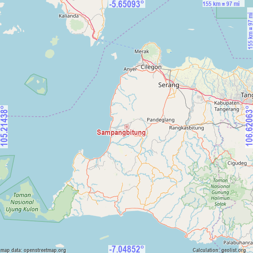
Sampangbitung GPS coordinates[2]
6° 21' 0.72" South, 105° 55' 3" East
| Map corner | latitude | longitude |
|---|---|---|
| Upper-left | -5.65093°, | 105.21438° |
| Center: | -6.3502°, | 105.9175° |
| Lower-right: | -7.04852°, | 106.62063° |
| Map W x H: | 155.4×155.4 km | = 96.6×96.6mi |
| max Lat: | 5.88969° ⇑13.8% North |
| Sampangbitung: | -6.3502° |
| min Lat: | ⇓86.2% South -10.934° |
| min Long | Sampangbitung | max Long |
| 95.1345° | 105.9175° | 140.9419° |
| W 7.8%⇐ | ⇒92.2% E |
Elevation
Elevation of Sampangbitung is 172 m = 564 ft, and this is 57.7 m = 189 ft below average elevation for this country.
| Max E: |
3185 m = 10449 ft | 39.3% |
| Avg. | 229.7 m = 754 ft | |
| Sampangbitung | 172 m = 564 ft | |
Min E: |
-1 m = -3 ft | 60.7% |
See also: Indonesia elevation on elevation.city.
Geographical zone
Sampangbitung is located in South Torrid zone (between Equator and Tropic of Capricorn). Distance of Equator is 706.1 km =438.8 mi to North.| Distance of | km | miles | from Sampangbitung |
|---|---|---|---|
| Equator | 706.1 | 438.8 | to North |
| Tropic Capricorn | 1899.8 | 1180.5 | to South |
| Antarctic Circle | 6695.1 | 4160.1 | to South |
| South Pole | 9301 | 5779.4 | to South |


Nearby cities:
15 places around Sampangbitung: (largest is in red/bold)
• Cigadung
1.9 km =1.2 mi,  17°
17°
• Cigandeng
2.5 km =1.6 mi,  146°
146°
• Cukangpanjang
2 km =1.2 mi,  334°
334°
• Jiput
1.9 km =1.2 mi,  290°
290°
• Kadubeureum
2.9 km =1.8 mi,  111°
111°
• Kaduheuleut
2.7 km =1.7 mi,  306°
306°
• Kadukotok
3.1 km =1.9 mi,  255°
255°
• Kadupager
2 km =1.2 mi,  85°
85°
• Kaduranca
1.8 km =1.1 mi,  131°
131°
• Kupahandap
3.1 km =1.9 mi, 150°
• Menes
2.8 km =1.7 mi,  177°
177°
• Munjul
2.3 km =1.4 mi,  67°
67°
• Muruy
2.6 km =1.6 mi,  227°
227°
• Pamarayan
2.1 km =1.3 mi,  254°
254°
• Sorodot
1.4 km =0.9 mi,  201°
201°
Sources, notices
• [Note1] Compared only with cities in Indonesia existing in our database
• [Src1] Map data: © OpenStreetMap contributors (CC-BY-SA)
• [Src2] Other city data from geonames.org with taken over terms of usage.
• [Src3] Geographical zone / Annual Mean Temperature by Robert A. Rohde @ Wikipedia
