Kalibuntu geodata
Kalibuntu (Banten) is a seat of a fourth-order administrative division; located in Indonesia in Asia/Jakarta (GMT+7) time zone. In our database, there are 407 cities with bigger population. Compared to other cities in Indonesia, 87.4% of cities are located further ↓South; 89.3% of cities are located further →East and 58.6% of cities have lower elevation than Kalibuntu. Note1


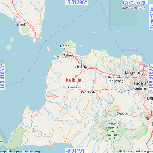
Kalibuntu GPS coordinates[2]
6° 12' 48.24" South, 106° 6' 49.68" East
| Map corner | latitude | longitude |
|---|---|---|
| Upper-left | -5.51396°, | 105.41068° |
| Center: | -6.2134°, | 106.1138° |
| Lower-right: | -6.91191°, | 106.81693° |
| Map W x H: | 155.4×155.4 km | = 96.6×96.6mi |
| max Lat: | 5.88969° ⇑12.6% North |
| Kalibuntu: | -6.2134° |
| min Lat: | ⇓87.4% South -10.934° |
| min Long | Kalibuntu | max Long |
| 95.1345° | 106.1138° | 140.9419° |
| W 10.7%⇐ | ⇒89.3% E |
Elevation
Elevation of Kalibuntu is 151 m = 495 ft, and this is 78.7 m = 258 ft below average elevation for this country.
| Max E: |
3185 m = 10449 ft | 41.4% |
| Avg. | 229.7 m = 754 ft | |
| Kalibuntu | 151 m = 495 ft | |
Min E: |
-1 m = -3 ft | 58.6% |
See also: Indonesia elevation on elevation.city.
Geographical zone
Kalibuntu is located in South Torrid zone (between Equator and Tropic of Capricorn). Distance of Equator is 690.9 km =429.3 mi to North.| Distance of | km | miles | from Kalibuntu |
|---|---|---|---|
| Equator | 690.9 | 429.3 | to North |
| Tropic Capricorn | 1915.1 | 1190 | to South |
| Antarctic Circle | 6710.3 | 4169.6 | to South |
| South Pole | 9316.2 | 5788.8 | to South |


Nearby cities:
15 places around Kalibuntu: (largest is in red/bold)
• Cemplang
4.6 km =2.9 mi,  246°
246°
• Cigudang
3.7 km =2.3 mi,  201°
201°
• Cikaung
3.6 km =2.2 mi,  286°
286°
• Jalanbaru
5.4 km =3.4 mi,  172°
172°
• Kaduela
5 km =3.1 mi,  225°
225°
• Kadukaung
3.9 km =2.4 mi,  191°
191°
• Lengor
1.7 km =1.1 mi, 194°
• Nagreg
2.8 km =1.7 mi,  256°
256°
• Pabuaran
4.8 km =3 mi,  282°
282°
• Pancanagara
3.7 km =2.3 mi,  309°
309°
• Panyirapan
2.5 km =1.6 mi,  155°
155°
• Pasagipasir
3.6 km =2.2 mi,  13°
13°
• Sampiran
4.5 km =2.8 mi, 277°
• Sioah
0.9 km =0.6 mi,  336°
336°
• Sukacai
2.6 km =1.6 mi, 188°
Sources, notices
• [Note1] Compared only with cities in Indonesia existing in our database
• [Src1] Map data: © OpenStreetMap contributors (CC-BY-SA)
• [Src2] Other city data from geonames.org with taken over terms of usage.
• [Src3] Geographical zone / Annual Mean Temperature by Robert A. Rohde @ Wikipedia
