Jalanbaru geodata
Jalanbaru (Banten) is a seat of a fourth-order administrative division; located in Indonesia in Asia/Jakarta (GMT+7) time zone. In our database, there are 407 cities with bigger population. Compared to other cities in Indonesia, 87% of cities are located further ↓South; 89.2% of cities are located further →East and 67.9% of cities have lower elevation than Jalanbaru. Note1


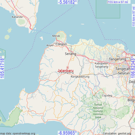
Jalanbaru GPS coordinates[2]
6° 15' 40.32" South, 106° 7' 13.08" East
| Map corner | latitude | longitude |
|---|---|---|
| Upper-left | -5.56182°, | 105.41718° |
| Center: | -6.2612°, | 106.1203° |
| Lower-right: | -6.95965°, | 106.82343° |
| Map W x H: | 155.4×155.4 km | = 96.6×96.6mi |
| max Lat: | 5.88969° ⇑13% North |
| Jalanbaru: | -6.2612° |
| min Lat: | ⇓87% South -10.934° |
| min Long | Jalanbaru | max Long |
| 95.1345° | 106.1203° | 140.9419° |
| W 10.8%⇐ | ⇒89.2% E |
Elevation
Elevation of Jalanbaru is 261 m = 856 ft, and this is 31.3 m = 103 ft above average elevation for this country.
| Max E: |
3185 m = 10449 ft | 32.1% |
| Jalanbaru | 261 m 856 ft | |
| Avg. | 229.7 m = 754 ft | |
Min E: |
-1 m = -3 ft | 67.9% |
See also: Indonesia elevation on elevation.city.
Geographical zone
Jalanbaru is located in South Torrid zone (between Equator and Tropic of Capricorn). Distance of Equator is 696.2 km =432.6 mi to North.| Distance of | km | miles | from Jalanbaru |
|---|---|---|---|
| Equator | 696.2 | 432.6 | to North |
| Tropic Capricorn | 1909.7 | 1186.6 | to South |
| Antarctic Circle | 6705 | 4166.3 | to South |
| South Pole | 9310.9 | 5785.5 | to South |


Nearby cities:
15 places around Jalanbaru: (largest is in red/bold)
• Cigudang
2.8 km =1.7 mi,  312°
312°
• Juhut
4.1 km =2.5 mi,  201°
201°
• Kaburon
3 km =1.9 mi,  166°
166°
• Kaduela
4.7 km =2.9 mi,  292°
292°
• Kaduengang
5.1 km =3.2 mi,  271°
271°
• Kadukaung
2.1 km =1.3 mi,  315°
315°
• Kadumantung
3.2 km =2 mi,  183°
183°
• Kalepasan
4.5 km =2.8 mi, 271°
• Karangtanjung
3.2 km =2 mi,  163°
163°
• Keboncau
5.3 km =3.3 mi, 198°
• Lengor
3.9 km =2.4 mi,  342°
342°
• Panyirapan
3.1 km =1.9 mi,  6°
6°
• Sindanghayu
1.9 km =1.2 mi,  245°
245°
• Sukacai
3 km =1.9 mi, 338°
• Tanagara
2.8 km =1.7 mi,  260°
260°
Sources, notices
• [Note1] Compared only with cities in Indonesia existing in our database
• [Src1] Map data: © OpenStreetMap contributors (CC-BY-SA)
• [Src2] Other city data from geonames.org with taken over terms of usage.
• [Src3] Geographical zone / Annual Mean Temperature by Robert A. Rohde @ Wikipedia
