Lurah geodata
Lurah (Banten) is a seat of a fourth-order administrative division; located in Indonesia in Asia/Jakarta (GMT+7) time zone. In our database, there are 407 cities with bigger population. Compared to other cities in Indonesia, 83.9% of cities are located further ↓South; 88% of cities are located further →East and 58.4% of cities have lower elevation than Lurah. Note1


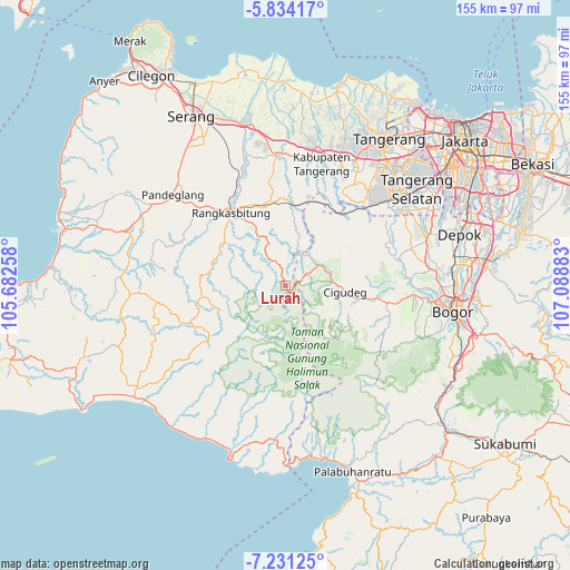
Lurah GPS coordinates[2]
6° 31' 59.52" South, 106° 23' 8.52" East
| Map corner | latitude | longitude |
|---|---|---|
| Upper-left | -5.83417°, | 105.68258° |
| Center: | -6.5332°, | 106.3857° |
| Lower-right: | -7.23125°, | 107.08883° |
| Map W x H: | 155.3×155.3 km | = 96.5×96.5mi |
| max Lat: | 5.88969° ⇑16.1% North |
| Lurah: | -6.5332° |
| min Lat: | ⇓83.9% South -10.934° |
| min Long | Lurah | max Long |
| 95.1345° | 106.3857° | 140.9419° |
| W 12%⇐ | ⇒88% E |
Elevation
Elevation of Lurah is 149 m = 489 ft, and this is 80.7 m = 265 ft below average elevation for this country.
| Max E: |
3185 m = 10449 ft | 41.6% |
| Avg. | 229.7 m = 754 ft | |
| Lurah | 149 m = 489 ft | |
Min E: |
-1 m = -3 ft | 58.4% |
See also: Indonesia elevation on elevation.city.
Geographical zone
Lurah is located in South Torrid zone (between Equator and Tropic of Capricorn). Distance of Equator is 726.4 km =451.4 mi to North.| Distance of | km | miles | from Lurah |
|---|---|---|---|
| Equator | 726.4 | 451.4 | to North |
| Tropic Capricorn | 1879.5 | 1167.9 | to South |
| Antarctic Circle | 6674.8 | 4147.5 | to South |
| South Pole | 9280.6 | 5766.7 | to South |


Nearby cities:
15 places around Lurah: (largest is in red/bold)
• Cigebrok
3.9 km =2.4 mi,  203°
203°
• Cikarae
2.8 km =1.7 mi,  189°
189°
• Cikomara
4.8 km =3 mi,  143°
143°
• Cimarkum
5.3 km =3.3 mi,  230°
230°
• Cipanas
2.3 km =1.4 mi, 142°
• Gajrug
0.9 km =0.6 mi,  316°
316°
• Guradog
3.1 km =1.9 mi,  13°
13°
• Hamberang Sabrang
2 km =1.2 mi,  105°
105°
• Kadubitung
3.6 km =2.2 mi,  263°
263°
• Leuwisema
1.4 km =0.9 mi,  295°
295°
• Malangnengah
2.9 km =1.8 mi,  279°
279°
• Padurung
6 km =3.7 mi,  175°
175°
• Puputan
3.9 km =2.4 mi, 225°
• Siangin
6.3 km =3.9 mi, 231°
• Sukamaju
0.6 km =0.4 mi,  53°
53°
Sources, notices
• [Note1] Compared only with cities in Indonesia existing in our database
• [Src1] Map data: © OpenStreetMap contributors (CC-BY-SA)
• [Src2] Other city data from geonames.org with taken over terms of usage.
• [Src3] Geographical zone / Annual Mean Temperature by Robert A. Rohde @ Wikipedia
