Malangnengah geodata
Malangnengah (Banten) is a seat of a fourth-order administrative division; located in Indonesia in Asia/Jakarta (GMT+7) time zone. In our database, there are 407 cities with bigger population. Compared to other cities in Indonesia, 84% of cities are located further ↓South; 88.1% of cities are located further →East and 53.4% of cities have lower elevation than Malangnengah. Note1


Malangnengah GPS coordinates[2]
6° 31' 44.4" South, 106° 21' 34.92" East
| Map corner | latitude | longitude |
|---|---|---|
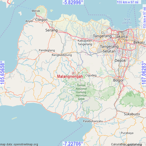
| Upper-left | -5.82996°, | 105.65658° |
| Center: | -6.529°, | 106.3597° |
| Lower-right: | -7.22706°, | 107.06283° |
| Map W x H: | 155.3×155.3 km | = 96.5×96.5mi |
| max Lat: | 5.88969° ⇑16% North |
| Malangnengah: | -6.529° |
| min Lat: | ⇓84% South -10.934° |
| min Long | Malangnengah | max Long |
| 95.1345° | 106.3597° | 140.9419° |
| W 11.9%⇐ | ⇒88.1% E |
Elevation
Elevation of Malangnengah is 116 m = 381 ft, and this is 113.7 m = 373 ft below average elevation for this country.
| Max E: |
3185 m = 10449 ft | 46.6% |
| Avg. | 229.7 m = 754 ft | |
| Malangnengah | 116 m = 381 ft | |
Min E: |
-1 m = -3 ft | 53.4% |
See also: Indonesia elevation on elevation.city.
Geographical zone
Malangnengah is located in South Torrid zone (between Equator and Tropic of Capricorn). Distance of Equator is 726 km =451.1 mi to North.| Distance of | km | miles | from Malangnengah |
|---|---|---|---|
| Equator | 726 | 451.1 | to North |
| Tropic Capricorn | 1880 | 1168.2 | to South |
| Antarctic Circle | 6675.2 | 4147.8 | to South |
| South Pole | 9281.1 | 5767 | to South |


Nearby cities:
15 places around Malangnengah: (largest is in red/bold)
• Cibeurih
4 km =2.5 mi,  238°
238°
• Cigebrok
4.3 km =2.7 mi,  162°
162°
• Cikarae
4 km =2.5 mi,  142°
142°
• Cimarkum
4 km =2.5 mi,  198°
198°
• Cipanas
4.9 km =3 mi,  118°
118°
• Gajrug
2.2 km =1.4 mi,  84°
84°
• Guradog
4.4 km =2.7 mi,  54°
54°
• Hamberang Sabrang
4.9 km =3 mi,  101°
101°
• Kadubitung
1.2 km =0.7 mi,  219°
219°
• Leuwisema
1.6 km =1 mi, 84°
• Lurah
2.9 km =1.8 mi, 99°
• Puputan
3.2 km =2 mi,  178°
178°
• Siangin
4.9 km =3 mi,  205°
205°
• Sukamaju
3.3 km =2.1 mi,  92°
92°
• Sumandang
4.2 km =2.6 mi,  306°
306°
Sources, notices
• [Note1] Compared only with cities in Indonesia existing in our database
• [Src1] Map data: © OpenStreetMap contributors (CC-BY-SA)
• [Src2] Other city data from geonames.org with taken over terms of usage.
• [Src3] Geographical zone / Annual Mean Temperature by Robert A. Rohde @ Wikipedia
