Bokor geodata
Bokor (West Java) is a seat of a fourth-order administrative division; located in Indonesia in Asia/Jakarta (GMT+7) time zone. In our database, there are 407 cities with bigger population. Compared to other cities in Indonesia, 56.6% of cities are located further ↑North; 83.8% of cities are located further →East and 51% of cities have lower elevation than Bokor. Note1


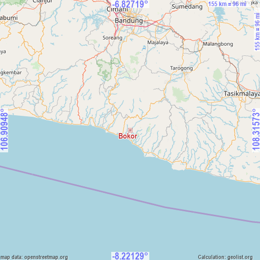
Bokor GPS coordinates[2]
7° 31' 29.28" South, 107° 36' 45.36" East
| Map corner | latitude | longitude |
|---|---|---|
| Upper-left | -6.82719°, | 106.90948° |
| Center: | -7.5248°, | 107.6126° |
| Lower-right: | -8.22129°, | 108.31573° |
| Map W x H: | 155×155 km | = 96.3×96.3mi |
| max Lat: | 5.88969° ⇑56.6% North |
| Bokor: | -7.5248° |
| min Lat: | ⇓43.4% South -10.934° |
| min Long | Bokor | max Long |
| 95.1345° | 107.6126° | 140.9419° |
| W 16.2%⇐ | ⇒83.8% E |
Elevation
Elevation of Bokor is 106 m = 348 ft, and this is 123.7 m = 406 ft below average elevation for this country.
| Max E: |
3185 m = 10449 ft | 49% |
| Avg. | 229.7 m = 754 ft | |
| Bokor | 106 m = 348 ft | |
Min E: |
-1 m = -3 ft | 51% |
See also: Indonesia elevation on elevation.city.
Geographical zone
Bokor is located in South Torrid zone (between Equator and Tropic of Capricorn). Distance of Equator is 836.7 km =519.9 mi to North.| Distance of | km | miles | from Bokor |
|---|---|---|---|
| Equator | 836.7 | 519.9 | to North |
| Tropic Capricorn | 1769.2 | 1099.3 | to South |
| Antarctic Circle | 6564.5 | 4079 | to South |
| South Pole | 9170.4 | 5698.2 | to South |


Nearby cities:
15 places around Bokor: (largest is in red/bold)
• Babakansalam
2.9 km =1.8 mi,  29°
29°
• Bungbulang
7.7 km =4.8 mi,  348°
348°
• Cibitung
8.2 km =5.1 mi,  98°
98°
• Cijaringao
8.1 km =5 mi,  265°
265°
• Cijayana
5.9 km =3.7 mi,  239°
239°
• Cikalong
6.8 km =4.2 mi,  62°
62°
• Cikuya
8.2 km =5.1 mi,  330°
330°
• Hanjuang
6.9 km =4.3 mi,  344°
344°
• Karangsari
5.7 km =3.5 mi,  174°
174°
• Pamungguan
5.3 km =3.3 mi,  5°
5°
• Pasireunteung
4.5 km =2.8 mi,  303°
303°
• Rahayu
8.1 km =5 mi, 25°
• Tegalastana
4.5 km =2.8 mi, 339°
• Tegalgede
5.8 km =3.6 mi,  51°
51°
• Tegallega
8.3 km =5.2 mi,  316°
316°
Sources, notices
• [Note1] Compared only with cities in Indonesia existing in our database
• [Src1] Map data: © OpenStreetMap contributors (CC-BY-SA)
• [Src2] Other city data from geonames.org with taken over terms of usage.
• [Src3] Geographical zone / Annual Mean Temperature by Robert A. Rohde @ Wikipedia
