Tegallega geodata
Tegallega (West Java) is a seat of a fourth-order administrative division; located in Indonesia in Asia/Jakarta (GMT+7) time zone. In our database, there are 407 cities with bigger population. Compared to other cities in Indonesia, 55.1% of cities are located further ↑North; 83.9% of cities are located further →East and 85.7% of cities have lower elevation than Tegallega. Note1


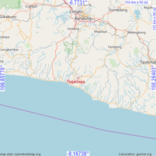
Tegallega GPS coordinates[2]
7° 28' 14.88" South, 107° 33' 39.24" East
| Map corner | latitude | longitude |
|---|---|---|
| Upper-left | -6.7731°, | 106.85778° |
| Center: | -7.4708°, | 107.5609° |
| Lower-right: | -8.16738°, | 108.26403° |
| Map W x H: | 155×155 km | = 96.3×96.3mi |
| max Lat: | 5.88969° ⇑55.1% North |
| Tegallega: | -7.4708° |
| min Lat: | ⇓44.9% South -10.934° |
| min Long | Tegallega | max Long |
| 95.1345° | 107.5609° | 140.9419° |
| W 16.1%⇐ | ⇒83.9% E |
Elevation
Elevation of Tegallega is 532 m = 1745 ft, and this is 302.3 m = 992 ft above average elevation for this country.
| Max E: |
3185 m = 10449 ft | 14.3% |
| Tegallega | 532 m 1745 ft | |
| Avg. | 229.7 m = 754 ft | |
Min E: |
-1 m = -3 ft | 85.7% |
See also: Indonesia elevation on elevation.city.
Geographical zone
Tegallega is located in South Torrid zone (between Equator and Tropic of Capricorn). Distance of Equator is 830.7 km =516.2 mi to North.| Distance of | km | miles | from Tegallega |
|---|---|---|---|
| Equator | 830.7 | 516.2 | to North |
| Tropic Capricorn | 1775.2 | 1103.1 | to South |
| Antarctic Circle | 6570.5 | 4082.7 | to South |
| South Pole | 9176.4 | 5701.9 | to South |


Nearby cities:
15 places around Tegallega: (largest is in red/bold)
• Babakansalam
7.9 km =4.9 mi,  116°
116°
• Batutumpang
7.9 km =4.9 mi,  61°
61°
• Bungbulang
4.5 km =2.8 mi,  69°
69°
• Caringin
5.5 km =3.4 mi,  289°
289°
• Cibeureum
3.8 km =2.4 mi,  0°
0°
• Cibolang
5.8 km =3.6 mi,  50°
50°
• Cijaringao
7.1 km =4.4 mi,  199°
199°
• Cikalaces
3.3 km =2.1 mi,  230°
230°
• Cikuya
2.1 km =1.3 mi, 55°
• Hanjuang
3.9 km =2.4 mi,  80°
80°
• Nagrak
4.8 km =3 mi, 54°
• Pamungguan
6.3 km =3.9 mi,  96°
96°
• Pasireunteung
4.1 km =2.5 mi,  151°
151°
• Sukarame
4.8 km =3 mi,  319°
319°
• Tegalastana
4.5 km =2.8 mi,  112°
112°
Sources, notices
• [Note1] Compared only with cities in Indonesia existing in our database
• [Src1] Map data: © OpenStreetMap contributors (CC-BY-SA)
• [Src2] Other city data from geonames.org with taken over terms of usage.
• [Src3] Geographical zone / Annual Mean Temperature by Robert A. Rohde @ Wikipedia
