Sukamaju geodata
Sukamaju (West Java) is a seat of a fourth-order administrative division; located in Indonesia in Asia/Jakarta (GMT+7) time zone. In our database, there are 407 cities with bigger population. Compared to other cities in Indonesia, 56.4% of cities are located further ↓South; 85.8% of cities are located further →East and 86.6% of cities have lower elevation than Sukamaju. Note1


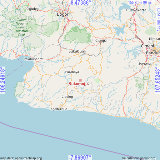
Sukamaju GPS coordinates[2]
7° 10' 19.2" South, 106° 56' 57.48" East
| Map corner | latitude | longitude |
|---|---|---|
| Upper-left | -6.47386°, | 106.24618° |
| Center: | -7.172°, | 106.9493° |
| Lower-right: | -7.86907°, | 107.65243° |
| Map W x H: | 155.1×155.1 km | = 96.4×96.4mi |
| max Lat: | 5.88969° ⇑43.6% North |
| Sukamaju: | -7.172° |
| min Lat: | ⇓56.4% South -10.934° |
| min Long | Sukamaju | max Long |
| 95.1345° | 106.9493° | 140.9419° |
| W 14.2%⇐ | ⇒85.8% E |
Elevation
Elevation of Sukamaju is 550 m = 1804 ft, and this is 320.3 m = 1051 ft above average elevation for this country.
| Max E: |
3185 m = 10449 ft | 13.4% |
| Sukamaju | 550 m 1804 ft | |
| Avg. | 229.7 m = 754 ft | |
Min E: |
-1 m = -3 ft | 86.6% |
See also: Indonesia elevation on elevation.city.
Geographical zone
Sukamaju is located in South Torrid zone (between Equator and Tropic of Capricorn). Distance of Equator is 797.5 km =495.5 mi to North.| Distance of | km | miles | from Sukamaju |
|---|---|---|---|
| Equator | 797.5 | 495.5 | to North |
| Tropic Capricorn | 1808.5 | 1123.7 | to South |
| Antarctic Circle | 6603.7 | 4103.3 | to South |
| South Pole | 9209.6 | 5722.6 | to South |


Nearby cities:
15 places around Sukamaju: (largest is in red/bold)
• Ciakar
6.5 km =4 mi,  225°
225°
• Cibaregbeg Dua
7.9 km =4.9 mi,  279°
279°
• Cibogo Dua
6.8 km =4.2 mi,  122°
122°
• Ciherang Dua
6.9 km =4.3 mi,  236°
236°
• Cikulina
7.5 km =4.7 mi,  147°
147°
• Curugkembar Satu
4.9 km =3 mi,  197°
197°
• Dampit Satu
4.8 km =3 mi,  71°
71°
• Kalapanunggal
7.7 km =4.8 mi,  127°
127°
• Najeng
7.1 km =4.4 mi,  179°
179°
• Puncakmanis
4.1 km =2.5 mi,  157°
157°
• Simpang
6.9 km =4.3 mi,  59°
59°
• Sindangraja
7.4 km =4.6 mi,  346°
346°
• Sumurnanjung
7.6 km =4.7 mi, 200°
• Tanahbeureum
7.4 km =4.6 mi,  12°
12°
• Tegaljaya
5.8 km =3.6 mi,  218°
218°
Sources, notices
• [Note1] Compared only with cities in Indonesia existing in our database
• [Src1] Map data: © OpenStreetMap contributors (CC-BY-SA)
• [Src2] Other city data from geonames.org with taken over terms of usage.
• [Src3] Geographical zone / Annual Mean Temperature by Robert A. Rohde @ Wikipedia
