Cibenda geodata
Cibenda (West Java) is a seat of a fourth-order administrative division; located in Indonesia in Asia/Jakarta (GMT+7) time zone. In our database, there are 407 cities with bigger population. Compared to other cities in Indonesia, 50.7% of cities are located further ↓South; 78.4% of cities are located further →East and 83.5% of cities have lower elevation than Cibenda. Note1


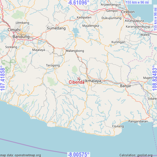
Cibenda GPS coordinates[2]
7° 18' 32.04" South, 108° 7' 18.12" East
| Map corner | latitude | longitude |
|---|---|---|
| Upper-left | -6.61096°, | 107.41858° |
| Center: | -7.3089°, | 108.1217° |
| Lower-right: | -8.00575°, | 108.82483° |
| Map W x H: | 155.1×155.1 km | = 96.4×96.4mi |
| max Lat: | 5.88969° ⇑49.3% North |
| Cibenda: | -7.3089° |
| min Lat: | ⇓50.7% South -10.934° |
| min Long | Cibenda | max Long |
| 95.1345° | 108.1217° | 140.9419° |
| W 21.6%⇐ | ⇒78.4% E |
Elevation
Elevation of Cibenda is 488 m = 1601 ft, and this is 258.3 m = 847 ft above average elevation for this country.
| Max E: |
3185 m = 10449 ft | 16.5% |
| Cibenda | 488 m 1601 ft | |
| Avg. | 229.7 m = 754 ft | |
Min E: |
-1 m = -3 ft | 83.5% |
See also: Indonesia elevation on elevation.city.
Geographical zone
Cibenda is located in South Torrid zone (between Equator and Tropic of Capricorn). Distance of Equator is 812.7 km =505 mi to North.| Distance of | km | miles | from Cibenda |
|---|---|---|---|
| Equator | 812.7 | 505 | to North |
| Tropic Capricorn | 1793.2 | 1114.2 | to South |
| Antarctic Circle | 6588.5 | 4093.9 | to South |
| South Pole | 9194.4 | 5713.1 | to South |


Nearby cities:
15 places around Cibenda: (largest is in red/bold)
• Arjasari
3.8 km =2.4 mi,  216°
216°
• Banjarsari
2.7 km =1.7 mi,  104°
104°
• Bebedahan
2.9 km =1.8 mi,  281°
281°
• Ciawang
1.7 km =1.1 mi,  211°
211°
• Cihanjuang
3.4 km =2.1 mi,  20°
20°
• Cihaseum
3.5 km =2.2 mi,  345°
345°
• Golacir
2.3 km =1.4 mi,  169°
169°
• Gunungbatara
2.4 km =1.5 mi,  119°
119°
• Kubangeceng
1.5 km =0.9 mi, 20°
• Nanggorak
2.5 km =1.6 mi,  250°
250°
• Pagaden
4.1 km =2.5 mi,  108°
108°
• Pasiripis
1.4 km =0.9 mi,  318°
318°
• Peundeuy
2.4 km =1.5 mi, 284°
• Sayuran
3.6 km =2.2 mi, 206°
• Selawangi
4 km =2.5 mi, 224°
Sources, notices
• [Note1] Compared only with cities in Indonesia existing in our database
• [Src1] Map data: © OpenStreetMap contributors (CC-BY-SA)
• [Src2] Other city data from geonames.org with taken over terms of usage.
• [Src3] Geographical zone / Annual Mean Temperature by Robert A. Rohde @ Wikipedia
