Gunungbatara geodata
Gunungbatara (West Java) is a seat of a fourth-order administrative division; located in Indonesia in Asia/Jakarta (GMT+7) time zone. In our database, there are 407 cities with bigger population. Compared to other cities in Indonesia, 50.3% of cities are located further ↓South; 77.9% of cities are located further →East and 81.5% of cities have lower elevation than Gunungbatara. Note1


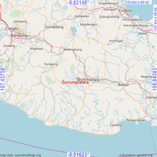
Gunungbatara GPS coordinates[2]
7° 19' 9.84" South, 108° 8' 26.52" East
| Map corner | latitude | longitude |
|---|---|---|
| Upper-left | -6.62148°, | 107.43758° |
| Center: | -7.3194°, | 108.1407° |
| Lower-right: | -8.01623°, | 108.84383° |
| Map W x H: | 155.1×155.1 km | = 96.4×96.4mi |
| max Lat: | 5.88969° ⇑49.7% North |
| Gunungbatara: | -7.3194° |
| min Lat: | ⇓50.3% South -10.934° |
| min Long | Gunungbatara | max Long |
| 95.1345° | 108.1407° | 140.9419° |
| W 22.1%⇐ | ⇒77.9% E |
Elevation
Elevation of Gunungbatara is 454 m = 1490 ft, and this is 224.3 m = 736 ft above average elevation for this country.
| Max E: |
3185 m = 10449 ft | 18.5% |
| Gunungbatara | 454 m 1490 ft | |
| Avg. | 229.7 m = 754 ft | |
Min E: |
-1 m = -3 ft | 81.5% |
See also: Indonesia elevation on elevation.city.
Geographical zone
Gunungbatara is located in South Torrid zone (between Equator and Tropic of Capricorn). Distance of Equator is 813.8 km =505.7 mi to North.| Distance of | km | miles | from Gunungbatara |
|---|---|---|---|
| Equator | 813.8 | 505.7 | to North |
| Tropic Capricorn | 1792.1 | 1113.6 | to South |
| Antarctic Circle | 6587.3 | 4093.2 | to South |
| South Pole | 9193.2 | 5712.4 | to South |


Nearby cities:
15 places around Gunungbatara: (largest is in red/bold)
• Banjarsari
0.7 km =0.4 mi,  49°
49°
• Bungursari
3.8 km =2.4 mi,  61°
61°
• Ciawang
3 km =1.9 mi,  263°
263°
• Cibenda
2.4 km =1.5 mi,  299°
299°
• Cidamar
3 km =1.9 mi,  184°
184°
• Cikondang
4 km =2.5 mi, 50°
• Cimanglid
4.2 km =2.6 mi,  226°
226°
• Golacir
2 km =1.2 mi,  235°
235°
• Gunungangka
3.7 km =2.3 mi,  135°
135°
• Gunungkawung
2.4 km =1.5 mi,  156°
156°
• Kubangeceng
3 km =1.9 mi,  328°
328°
• Pagaden
1.8 km =1.1 mi,  95°
95°
• Pasirangin
3.4 km =2.1 mi,  83°
83°
• Pasiripis
3.8 km =2.4 mi,  306°
306°
• Pasiripis
4 km =2.5 mi, 137°
Sources, notices
• [Note1] Compared only with cities in Indonesia existing in our database
• [Src1] Map data: © OpenStreetMap contributors (CC-BY-SA)
• [Src2] Other city data from geonames.org with taken over terms of usage.
• [Src3] Geographical zone / Annual Mean Temperature by Robert A. Rohde @ Wikipedia
