Gunungbatu geodata
Gunungbatu (West Java) is a seat of a fourth-order administrative division; located in Indonesia in Asia/Jakarta (GMT+7) time zone. In our database, there are 407 cities with bigger population. Compared to other cities in Indonesia, 53.1% of cities are located further ↓South; 84.6% of cities are located further →East and 86.1% of cities have lower elevation than Gunungbatu. Note1


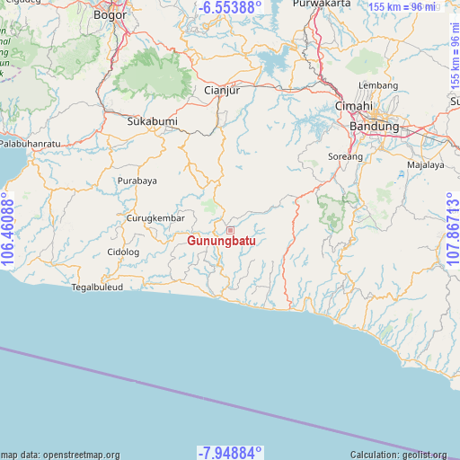
Gunungbatu GPS coordinates[2]
7° 15' 6.84" South, 107° 9' 50.4" East
| Map corner | latitude | longitude |
|---|---|---|
| Upper-left | -6.55388°, | 106.46088° |
| Center: | -7.2519°, | 107.164° |
| Lower-right: | -7.94884°, | 107.86713° |
| Map W x H: | 155.1×155.1 km | = 96.4×96.4mi |
| max Lat: | 5.88969° ⇑46.9% North |
| Gunungbatu: | -7.2519° |
| min Lat: | ⇓53.1% South -10.934° |
| min Long | Gunungbatu | max Long |
| 95.1345° | 107.164° | 140.9419° |
| W 15.4%⇐ | ⇒84.6% E |
Elevation
Elevation of Gunungbatu is 539 m = 1768 ft, and this is 309.3 m = 1015 ft above average elevation for this country.
| Max E: |
3185 m = 10449 ft | 13.9% |
| Gunungbatu | 539 m 1768 ft | |
| Avg. | 229.7 m = 754 ft | |
Min E: |
-1 m = -3 ft | 86.1% |
See also: Indonesia elevation on elevation.city.
Geographical zone
Gunungbatu is located in South Torrid zone (between Equator and Tropic of Capricorn). Distance of Equator is 806.3 km =501 mi to North.| Distance of | km | miles | from Gunungbatu |
|---|---|---|---|
| Equator | 806.3 | 501 | to North |
| Tropic Capricorn | 1799.6 | 1118.2 | to South |
| Antarctic Circle | 6594.8 | 4097.8 | to South |
| South Pole | 9200.7 | 5717 | to South |


Nearby cities:
15 places around Gunungbatu: (largest is in red/bold)
• Ankola
7.4 km =4.6 mi,  213°
213°
• Babakan
7.3 km =4.5 mi,  117°
117°
• Babakantugu
8.6 km =5.3 mi,  264°
264°
• Bebedahan
2.7 km =1.7 mi,  254°
254°
• Cireundeu
8 km =5 mi,  185°
185°
• Cisasak
7.9 km =4.9 mi,  326°
326°
• Legokbuluh
5.5 km =3.4 mi,  302°
302°
• Pamoyanan
6.3 km =3.9 mi,  164°
164°
• Panineungan
4.2 km =2.6 mi, 123°
• Pasirmanggu
6.5 km =4 mi, 253°
• Rawawilis
8.6 km =5.3 mi, 248°
• Sinarwangi
7 km =4.3 mi,  244°
244°
• Tanggeung
4.8 km =3 mi, 248°
• Tanggeung Kolot
4.3 km =2.7 mi,  232°
232°
• Tegalpanjang
3.5 km =2.2 mi, 227°
Sources, notices
• [Note1] Compared only with cities in Indonesia existing in our database
• [Src1] Map data: © OpenStreetMap contributors (CC-BY-SA)
• [Src2] Other city data from geonames.org with taken over terms of usage.
• [Src3] Geographical zone / Annual Mean Temperature by Robert A. Rohde @ Wikipedia
