Cibeulah geodata
Cibeulah (West Java) is a seat of a fourth-order administrative division; located in Indonesia in Asia/Jakarta (GMT+7) time zone. In our database, there are 407 cities with bigger population. Compared to other cities in Indonesia, 50.3% of cities are located further ↓South; 71.9% of cities are located further →East and 55.8% of cities have lower elevation than Cibeulah. Note1


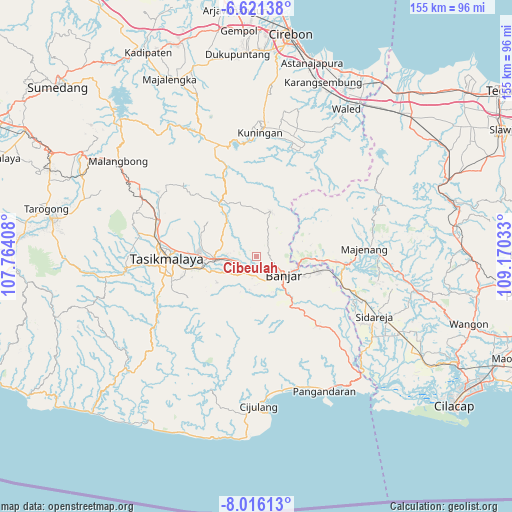
Cibeulah GPS coordinates[2]
7° 19' 9.48" South, 108° 28' 1.92" East
| Map corner | latitude | longitude |
|---|---|---|
| Upper-left | -6.62138°, | 107.76408° |
| Center: | -7.3193°, | 108.4672° |
| Lower-right: | -8.01613°, | 109.17033° |
| Map W x H: | 155.1×155.1 km | = 96.4×96.4mi |
| max Lat: | 5.88969° ⇑49.7% North |
| Cibeulah: | -7.3193° |
| min Lat: | ⇓50.3% South -10.934° |
| min Long | Cibeulah | max Long |
| 95.1345° | 108.4672° | 140.9419° |
| W 28.1%⇐ | ⇒71.9% E |
Elevation
Elevation of Cibeulah is 129 m = 423 ft, and this is 100.7 m = 330 ft below average elevation for this country.
| Max E: |
3185 m = 10449 ft | 44.2% |
| Avg. | 229.7 m = 754 ft | |
| Cibeulah | 129 m = 423 ft | |
Min E: |
-1 m = -3 ft | 55.8% |
See also: Indonesia elevation on elevation.city.
Geographical zone
Cibeulah is located in South Torrid zone (between Equator and Tropic of Capricorn). Distance of Equator is 813.8 km =505.7 mi to North.| Distance of | km | miles | from Cibeulah |
|---|---|---|---|
| Equator | 813.8 | 505.7 | to North |
| Tropic Capricorn | 1792.1 | 1113.6 | to South |
| Antarctic Circle | 6587.3 | 4093.2 | to South |
| South Pole | 9193.2 | 5712.4 | to South |


Nearby cities:
15 places around Cibeulah: (largest is in red/bold)
• Balokang
5.6 km =3.5 mi,  159°
159°
• Bantarsari
5.5 km =3.4 mi,  37°
37°
• Bojong
5 km =3.1 mi,  232°
232°
• Cempaka
5.5 km =3.4 mi,  95°
95°
• Cibeta
3.5 km =2.2 mi,  169°
169°
• Cigaleuh Kulon
4 km =2.5 mi,  297°
297°
• Cijeungjing Kaler
5.7 km =3.5 mi,  251°
251°
• Cimaragas
5.9 km =3.7 mi,  184°
184°
• Dusun Desa Bunter
3.2 km =2 mi,  358°
358°
• Karanganyar
5.3 km =3.3 mi,  285°
285°
• Kepel
2.9 km =1.8 mi,  134°
134°
• Kertabumi
3.6 km =2.2 mi,  241°
241°
• Sembungjaya
5.6 km =3.5 mi, 126°
• Sukaharja
1.8 km =1.1 mi, 254°
• Tenjolaya
2.8 km =1.7 mi, 99°
Sources, notices
• [Note1] Compared only with cities in Indonesia existing in our database
• [Src1] Map data: © OpenStreetMap contributors (CC-BY-SA)
• [Src2] Other city data from geonames.org with taken over terms of usage.
• [Src3] Geographical zone / Annual Mean Temperature by Robert A. Rohde @ Wikipedia
