Tunjungrejo geodata
Tunjungrejo (Central Java) is a seat of a fourth-order administrative division; located in Indonesia in Asia/Jakarta (GMT+7) time zone. In our database, there are 407 cities with bigger population. Compared to other cities in Indonesia, 82.7% of cities are located further ↓South; 63.9% of cities are located further →East and 93.7% of cities have higher elevation than Tunjungrejo. Note1


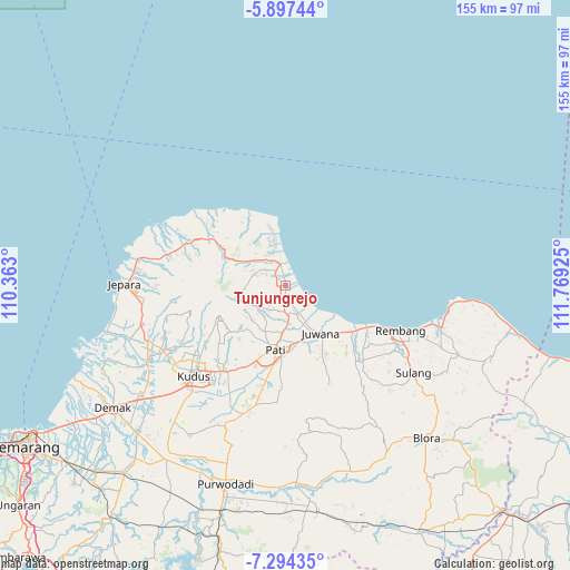
Tunjungrejo GPS coordinates[2]
6° 35' 47.004" South, 111° 3' 58.032" East
| Map corner | latitude | longitude |
|---|---|---|
| Upper-left | -5.89744°, | 110.363° |
| Center: | -6.59639°, | 111.06612° |
| Lower-right: | -7.29435°, | 111.76925° |
| Map W x H: | 155.3×155.3 km | = 96.5×96.5mi |
| max Lat: | 5.88969° ⇑17.3% North |
| Tunjungrejo: | -6.59639° |
| min Lat: | ⇓82.7% South -10.934° |
| min Long | Tunjungrejo | max Long |
| 95.1345° | 111.06612° | 140.9419° |
| W 36.1%⇐ | ⇒63.9% E |
Elevation
Elevation of Tunjungrejo is 8 m = 26 ft, and this is 221.7 m = 727 ft below average elevation for this country.
| Max E: |
3185 m = 10449 ft | 93.7% |
| Avg. | 229.7 m = 754 ft | |
| Tunjungrejo | 8 m = 26 ft | |
Min E: |
-1 m = -3 ft | 6.3% |
See also: Indonesia elevation on elevation.city.
Geographical zone
Tunjungrejo is located in South Torrid zone (between Equator and Tropic of Capricorn). Distance of Equator is 733.4 km =455.7 mi to North.| Distance of | km | miles | from Tunjungrejo |
|---|---|---|---|
| Equator | 733.4 | 455.7 | to North |
| Tropic Capricorn | 1872.5 | 1163.5 | to South |
| Antarctic Circle | 6667.7 | 4143.1 | to South |
| South Pole | 9273.6 | 5762.3 | to South |


Nearby cities:
15 places around Tunjungrejo: (largest is in red/bold)
• Babatan
2.1 km =1.3 mi,  219°
219°
• Bancaran
3.2 km =2 mi,  306°
306°
• Belahan
2.8 km =1.7 mi,  346°
346°
• Bulumanis Kidul
1.9 km =1.2 mi,  170°
170°
• Bulumanis Lor
1.3 km =0.8 mi,  177°
177°
• Cibolek Kidul
0.5 km =0.3 mi, 183°
• Kajen
1.4 km =0.9 mi,  212°
212°
• Kedung
2.5 km =1.6 mi,  263°
263°
• Krajan Waturoyo
1.1 km =0.7 mi,  277°
277°
• Margotuhu Kidul
2.1 km =1.3 mi,  343°
343°
• Margoyoso
0.4 km =0.2 mi, 344°
• Mrican
2.8 km =1.7 mi, 276°
• Pangkalan
2.8 km =1.7 mi,  151°
151°
• Sekarjalak
1.9 km =1.2 mi, 182°
• Semerak
2.1 km =1.3 mi,  328°
328°
Sources, notices
• [Note1] Compared only with cities in Indonesia existing in our database
• [Src1] Map data: © OpenStreetMap contributors (CC-BY-SA)
• [Src2] Other city data from geonames.org with taken over terms of usage.
• [Src3] Geographical zone / Annual Mean Temperature by Robert A. Rohde @ Wikipedia
