Cibolek Kidul geodata
Cibolek Kidul (Central Java) is a seat of a fourth-order administrative division; located in Indonesia in Asia/Jakarta (GMT+7) time zone. In our database, there are 407 cities with bigger population. Compared to other cities in Indonesia, 82.6% of cities are located further ↓South; 63.9% of cities are located further →East and 84.2% of cities have higher elevation than Cibolek Kidul. Note1


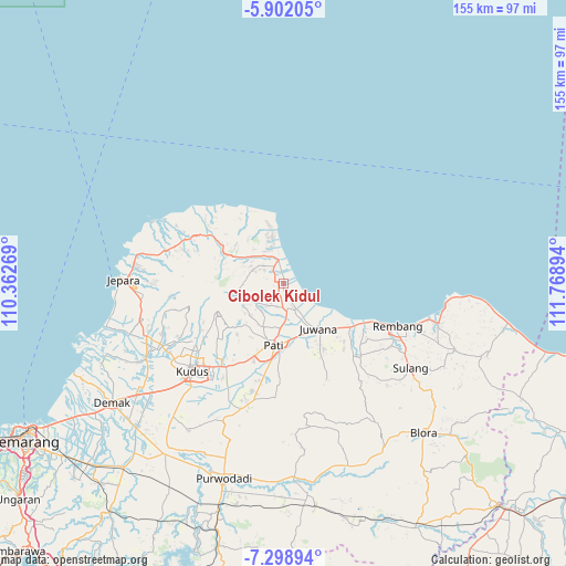
Cibolek Kidul GPS coordinates[2]
6° 36' 3.564" South, 111° 3' 56.916" East
| Map corner | latitude | longitude |
|---|---|---|
| Upper-left | -5.90205°, | 110.36269° |
| Center: | -6.60099°, | 111.06581° |
| Lower-right: | -7.29894°, | 111.76894° |
| Map W x H: | 155.3×155.3 km | = 96.5×96.5mi |
| max Lat: | 5.88969° ⇑17.4% North |
| Cibolek Kidul: | -6.60099° |
| min Lat: | ⇓82.6% South -10.934° |
| min Long | Cibolek Kidul | max Long |
| 95.1345° | 111.06581° | 140.9419° |
| W 36.1%⇐ | ⇒63.9% E |
Elevation
Elevation of Cibolek Kidul is 15 m = 49 ft, and this is 214.7 m = 704 ft below average elevation for this country.
| Max E: |
3185 m = 10449 ft | 84.2% |
| Avg. | 229.7 m = 754 ft | |
| Cibolek Kidul | 15 m = 49 ft | |
Min E: |
-1 m = -3 ft | 15.8% |
See also: Indonesia elevation on elevation.city.
Geographical zone
Cibolek Kidul is located in South Torrid zone (between Equator and Tropic of Capricorn). Distance of Equator is 734 km =456.1 mi to North.| Distance of | km | miles | from Cibolek Kidul |
|---|---|---|---|
| Equator | 734 | 456.1 | to North |
| Tropic Capricorn | 1872 | 1163.2 | to South |
| Antarctic Circle | 6667.2 | 4142.8 | to South |
| South Pole | 9273.1 | 5762 | to South |


Nearby cities:
15 places around Cibolek Kidul: (largest is in red/bold)
• Babatan
1.7 km =1.1 mi,  229°
229°
• Bulumanis Kidul
1.4 km =0.9 mi,  165°
165°
• Bulumanis Lor
0.8 km =0.5 mi, 173°
• Kajen
1 km =0.6 mi, 228°
• Kedung
2.4 km =1.5 mi,  275°
275°
• Krajan Waturoyo
1.2 km =0.7 mi,  302°
302°
• Margotuhu Kidul
2.6 km =1.6 mi,  347°
347°
• Margoyoso
0.9 km =0.6 mi,  355°
355°
• Mrican
2.8 km =1.7 mi,  286°
286°
• Pangkalan
2.4 km =1.5 mi,  144°
144°
• Pohijo
2.9 km =1.8 mi, 167°
• Sekarjalak
1.4 km =0.9 mi,  181°
181°
• Semerak
2.6 km =1.6 mi,  334°
334°
• Sidomukti
3 km =1.9 mi,  208°
208°
• Tunjungrejo
0.5 km =0.3 mi,  3°
3°
Sources, notices
• [Note1] Compared only with cities in Indonesia existing in our database
• [Src1] Map data: © OpenStreetMap contributors (CC-BY-SA)
• [Src2] Other city data from geonames.org with taken over terms of usage.
• [Src3] Geographical zone / Annual Mean Temperature by Robert A. Rohde @ Wikipedia
