Goge geodata
Goge (Central Java) is a seat of a fourth-order administrative division; located in Indonesia in Asia/Jakarta (GMT+7) time zone. In our database, there are 407 cities with bigger population. Compared to other cities in Indonesia, 75% of cities are located further ↓South; 62% of cities are located further →East and 59.8% of cities have higher elevation than Goge. Note1


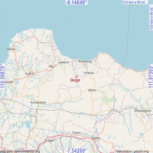
Goge GPS coordinates[2]
6° 50' 42.36" South, 111° 16' 18.84" East
| Map corner | latitude | longitude |
|---|---|---|
| Upper-left | -6.14649°, | 110.56878° |
| Center: | -6.8451°, | 111.2719° |
| Lower-right: | -7.54269°, | 111.97503° |
| Map W x H: | 155.2×155.2 km | = 96.4×96.4mi |
| max Lat: | 5.88969° ⇑25% North |
| Goge: | -6.8451° |
| min Lat: | ⇓75% South -10.934° |
| min Long | Goge | max Long |
| 95.1345° | 111.2719° | 140.9419° |
| W 38%⇐ | ⇒62% E |
Elevation
Elevation of Goge is 60 m = 197 ft, and this is 169.7 m = 557 ft below average elevation for this country.
| Max E: |
3185 m = 10449 ft | 59.8% |
| Avg. | 229.7 m = 754 ft | |
| Goge | 60 m = 197 ft | |
Min E: |
-1 m = -3 ft | 40.2% |
See also: Indonesia elevation on elevation.city.
Geographical zone
Goge is located in South Torrid zone (between Equator and Tropic of Capricorn). Distance of Equator is 761.1 km =472.9 mi to North.| Distance of | km | miles | from Goge |
|---|---|---|---|
| Equator | 761.1 | 472.9 | to North |
| Tropic Capricorn | 1844.8 | 1146.3 | to South |
| Antarctic Circle | 6640.1 | 4126 | to South |
| South Pole | 9246 | 5745.2 | to South |


Nearby cities:
15 places around Goge: (largest is in red/bold)
• Banyuurip
4.6 km =2.9 mi,  355°
355°
• Gaplokan
5.6 km =3.5 mi,  179°
179°
• Kalinanas
2.3 km =1.4 mi,  211°
211°
• Kedungbacin
5.7 km =3.5 mi,  244°
244°
• Kedungtulup
2.4 km =1.5 mi, 357°
• Kletek
5.5 km =3.4 mi,  282°
282°
• Krajan Tengah Sendangmulyo
5.6 km =3.5 mi,  99°
99°
• Krikilan
1.8 km =1.1 mi,  10°
10°
• Logung
2.4 km =1.5 mi,  46°
46°
• Mantup
5.3 km =3.3 mi,  328°
328°
• Mlatirejo
3.6 km =2.2 mi,  91°
91°
• Pandansili
2.3 km =1.4 mi,  66°
66°
• Pelemsari
4.7 km =2.9 mi, 71°
• Ronggo
1.8 km =1.1 mi, 283°
• Sumber
5.5 km =3.4 mi,  342°
342°
Sources, notices
• [Note1] Compared only with cities in Indonesia existing in our database
• [Src1] Map data: © OpenStreetMap contributors (CC-BY-SA)
• [Src2] Other city data from geonames.org with taken over terms of usage.
• [Src3] Geographical zone / Annual Mean Temperature by Robert A. Rohde @ Wikipedia
