Krajan Tengah Sendangmulyo geodata
Krajan Tengah Sendangmulyo (Central Java) is a seat of a fourth-order administrative division; located in Indonesia in Asia/Jakarta (GMT+7) time zone. In our database, there are 407 cities with bigger population. Compared to other cities in Indonesia, 74.9% of cities are located further ↓South; 61.4% of cities are located further →East and 52.5% of cities have lower elevation than Krajan Tengah Sendangmulyo. Note1
Current local time in Krajan Tengah Sendangmulyo:
08:24 PM, SundayDifference from your time zone: hours


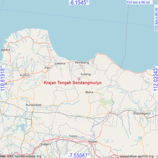
Krajan Tengah Sendangmulyo GPS coordinates[2]
6° 51' 11.16" South, 111° 19' 20.28" East
| Map corner | latitude | longitude |
|---|---|---|
| Upper-left | -6.1545°, | 110.61918° |
| Center: | -6.8531°, | 111.3223° |
| Lower-right: | -7.55067°, | 112.02543° |
| Map W x H: | 155.2×155.2 km | = 96.4×96.4mi |
| max Lat: | 5.88969° ⇑25.1% North |
| Krajan Tengah Sendangmulyo: | -6.8531° |
| min Lat: | ⇓74.9% South -10.934° |
| min Long | Krajan Tengah S | max Long |
| 95.1345° | 111.3223° | 140.9419° |
| W 38.6%⇐ | ⇒61.4% E |
Elevation
Elevation of Krajan Tengah Sendangmulyo is 112 m = 367 ft, and this is 117.7 m = 386 ft below average elevation for this country.
| Max E: |
3185 m = 10449 ft | 47.5% |
| Avg. | 229.7 m = 754 ft | |
| Krajan Tengah Sendangmulyo | 112 m = 367 ft | |
Min E: |
-1 m = -3 ft | 52.5% |
See also: Indonesia elevation on elevation.city.
Geographical zone
Krajan Tengah Sendangmulyo is located in South Torrid zone (between Equator and Tropic of Capricorn). Distance of Equator is 762 km =473.5 mi to North.| Distance of | km | miles | from Krajan Tengah Sendangmulyo |
|---|---|---|---|
| Equator | 762 | 473.5 | to North |
| Tropic Capricorn | 1843.9 | 1145.7 | to South |
| Antarctic Circle | 6639.2 | 4125.4 | to South |
| South Pole | 9245.1 | 5744.6 | to South |


Nearby cities:
15 places around Krajan Tengah Sendangmulyo: (largest is in red/bold)
• Cabean
3.9 km =2.4 mi,  71°
71°
• Goge
5.6 km =3.5 mi,  279°
279°
• Karangasem
4.6 km =2.9 mi,  87°
87°
• Krikilan
5.9 km =3.7 mi,  297°
297°
• Lambangan Kulon
4.5 km =2.8 mi,  63°
63°
• Lambangan Wetan
5.6 km =3.5 mi, 61°
• Logung
4.6 km =2.9 mi, 303°
• Mlatirejo
2.1 km =1.3 mi,  291°
291°
• Ngaglik
5.2 km =3.2 mi, 73°
• Ngiyono
5.3 km =3.3 mi,  192°
192°
• Ngrojo
3.9 km =2.4 mi, 58°
• Pandansili
3.9 km =2.4 mi, 297°
• Pelemsari
2.6 km =1.6 mi,  334°
334°
• Pinggan
2.5 km =1.6 mi,  78°
78°
• Pondokrejo Wetan
1.9 km =1.2 mi,  6°
6°
Sources, notices
• [Note1] Compared only with cities in Indonesia existing in our database
• [Src1] Map data: © OpenStreetMap contributors (CC-BY-SA)
• [Src2] Other city data from geonames.org with taken over terms of usage.
• [Src3] Geographical zone / Annual Mean Temperature by Robert A. Rohde @ Wikipedia
