Plawangan geodata
Plawangan (Central Java) is a seat of a fourth-order administrative division; located in Indonesia in Asia/Jakarta (GMT+7) time zone. In our database, there are 407 cities with bigger population. Compared to other cities in Indonesia, 81.4% of cities are located further ↓South; 56.3% of cities are located further →East and 97.2% of cities have higher elevation than Plawangan. Note1


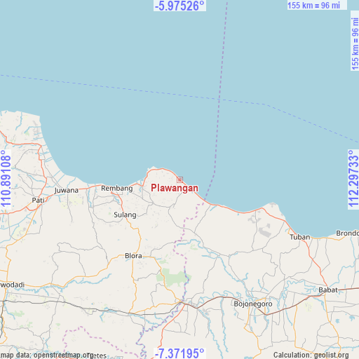
Plawangan GPS coordinates[2]
6° 40' 26.76" South, 111° 35' 39.12" East
| Map corner | latitude | longitude |
|---|---|---|
| Upper-left | -5.97526°, | 110.89108° |
| Center: | -6.6741°, | 111.5942° |
| Lower-right: | -7.37195°, | 112.29733° |
| Map W x H: | 155.3×155.3 km | = 96.5×96.5mi |
| max Lat: | 5.88969° ⇑18.6% North |
| Plawangan: | -6.6741° |
| min Lat: | ⇓81.4% South -10.934° |
| min Long | Plawangan | max Long |
| 95.1345° | 111.5942° | 140.9419° |
| W 43.7%⇐ | ⇒56.3% E |
Elevation
Elevation of Plawangan is 6 m = 20 ft, and this is 223.7 m = 734 ft below average elevation for this country.
| Max E: |
3185 m = 10449 ft | 97.2% |
| Avg. | 229.7 m = 754 ft | |
| Plawangan | 6 m = 20 ft | |
Min E: |
-1 m = -3 ft | 2.8% |
See also: Indonesia elevation on elevation.city.
Geographical zone
Plawangan is located in South Torrid zone (between Equator and Tropic of Capricorn). Distance of Equator is 742.1 km =461.1 mi to North.| Distance of | km | miles | from Plawangan |
|---|---|---|---|
| Equator | 742.1 | 461.1 | to North |
| Tropic Capricorn | 1863.8 | 1158.1 | to South |
| Antarctic Circle | 6659.1 | 4137.8 | to South |
| South Pole | 9265 | 5757 | to South |


Nearby cities:
15 places around Plawangan: (largest is in red/bold)
• Balongmulyo
1.1 km =0.7 mi,  132°
132°
• Karangharjo
4.4 km =2.7 mi, 129°
• Kendalagung
4.1 km =2.5 mi,  164°
164°
• Kragan
2.7 km =1.7 mi, 130°
• Krajan Sumurtawang
3.4 km =2.1 mi,  289°
289°
• Krajan Woro
3.4 km =2.1 mi,  277°
277°
• Narukan
2.6 km =1.6 mi,  209°
209°
• Pandangan Kulon
1 km =0.6 mi,  324°
324°
• Pandangan Wetan
0.7 km =0.4 mi,  310°
310°
• Sendangwaru
4.3 km =2.7 mi, 211°
• Sudan
3 km =1.9 mi, 214°
• Sumbergayam
0.6 km =0.4 mi,  263°
263°
• Sumbersari
4.4 km =2.7 mi, 315°
• Sumurpule
2 km =1.2 mi,  221°
221°
• Terjan
4 km =2.5 mi,  235°
235°
Sources, notices
• [Note1] Compared only with cities in Indonesia existing in our database
• [Src1] Map data: © OpenStreetMap contributors (CC-BY-SA)
• [Src2] Other city data from geonames.org with taken over terms of usage.
• [Src3] Geographical zone / Annual Mean Temperature by Robert A. Rohde @ Wikipedia
