Patingen Dua geodata
Patingen Dua (West Java) is a seat of a fourth-order administrative division; located in Indonesia in Asia/Jakarta (GMT+7) time zone. In our database, there are 407 cities with bigger population. Compared to other cities in Indonesia, 57% of cities are located further ↑North; 68.9% of cities are located further →East and 84.2% of cities have higher elevation than Patingen Dua. Note1


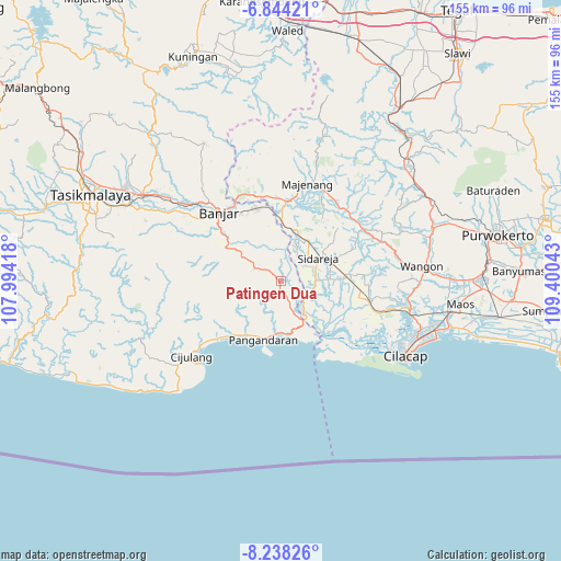
Patingen Dua GPS coordinates[2]
7° 32' 30.48" South, 108° 41' 50.28" East
| Map corner | latitude | longitude |
|---|---|---|
| Upper-left | -6.84421°, | 107.99418° |
| Center: | -7.5418°, | 108.6973° |
| Lower-right: | -8.23826°, | 109.40043° |
| Map W x H: | 155×155 km | = 96.3×96.3mi |
| max Lat: | 5.88969° ⇑57% North |
| Patingen Dua: | -7.5418° |
| min Lat: | ⇓43% South -10.934° |
| min Long | Patingen Dua | max Long |
| 95.1345° | 108.6973° | 140.9419° |
| W 31.1%⇐ | ⇒68.9% E |
Elevation
Elevation of Patingen Dua is 15 m = 49 ft, and this is 214.7 m = 704 ft below average elevation for this country.
| Max E: |
3185 m = 10449 ft | 84.2% |
| Avg. | 229.7 m = 754 ft | |
| Patingen Dua | 15 m = 49 ft | |
Min E: |
-1 m = -3 ft | 15.8% |
See also: Indonesia elevation on elevation.city.
Geographical zone
Patingen Dua is located in South Torrid zone (between Equator and Tropic of Capricorn). Distance of Equator is 838.6 km =521.1 mi to North.| Distance of | km | miles | from Patingen Dua |
|---|---|---|---|
| Equator | 838.6 | 521.1 | to North |
| Tropic Capricorn | 1767.3 | 1098.1 | to South |
| Antarctic Circle | 6562.6 | 4077.8 | to South |
| South Pole | 9168.5 | 5697 | to South |


Nearby cities:
15 places around Patingen Dua: (largest is in red/bold)
• Babakanjaya
4.6 km =2.9 mi,  209°
209°
• Burujul
1.5 km =0.9 mi,  252°
252°
• Cibeureum
3.4 km =2.1 mi,  334°
334°
• Cihideung
5.2 km =3.2 mi,  158°
158°
• Ciilat
3.1 km =1.9 mi,  87°
87°
• Cinangka
5.1 km =3.2 mi, 251°
• Kawarasan
3.1 km =1.9 mi,  175°
175°
• Kedungwuluh
1.3 km =0.8 mi,  300°
300°
• Maruyungsari
4.6 km =2.9 mi,  53°
53°
• Nagrak
2.4 km =1.5 mi,  187°
187°
• Padaherang
0.9 km =0.6 mi, 191°
• Pasirgeulis
4.4 km =2.7 mi,  323°
323°
• Sentul
4.8 km =3 mi,  113°
113°
• Sidaurip
5.8 km =3.6 mi, 89°
• Sopla
3.4 km =2.1 mi,  313°
313°
Sources, notices
• [Note1] Compared only with cities in Indonesia existing in our database
• [Src1] Map data: © OpenStreetMap contributors (CC-BY-SA)
• [Src2] Other city data from geonames.org with taken over terms of usage.
• [Src3] Geographical zone / Annual Mean Temperature by Robert A. Rohde @ Wikipedia
