Bangunrejo geodata
Bangunrejo (Central Java) is a seat of a fourth-order administrative division; located in Indonesia in Asia/Jakarta (GMT+7) time zone. In our database, there are 407 cities with bigger population. Compared to other cities in Indonesia, 77.2% of cities are located further ↓South; 57.6% of cities are located further →East and 55.6% of cities have higher elevation than Bangunrejo. Note1


Bangunrejo GPS coordinates[2]
6° 46' 30.36" South, 111° 30' 54" East
| Map corner | latitude | longitude |
|---|---|---|
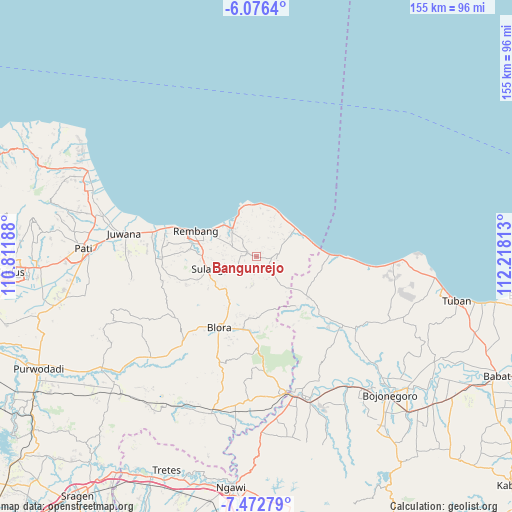
| Upper-left | -6.0764°, | 110.81188° |
| Center: | -6.7751°, | 111.515° |
| Lower-right: | -7.47279°, | 112.21813° |
| Map W x H: | 155.3×155.3 km | = 96.5×96.5mi |
| max Lat: | 5.88969° ⇑22.8% North |
| Bangunrejo: | -6.7751° |
| min Lat: | ⇓77.2% South -10.934° |
| min Long | Bangunrejo | max Long |
| 95.1345° | 111.515° | 140.9419° |
| W 42.4%⇐ | ⇒57.6% E |
Elevation
Elevation of Bangunrejo is 81 m = 266 ft, and this is 148.7 m = 488 ft below average elevation for this country.
| Max E: |
3185 m = 10449 ft | 55.6% |
| Avg. | 229.7 m = 754 ft | |
| Bangunrejo | 81 m = 266 ft | |
Min E: |
-1 m = -3 ft | 44.4% |
See also: Indonesia elevation on elevation.city.
Geographical zone
Bangunrejo is located in South Torrid zone (between Equator and Tropic of Capricorn). Distance of Equator is 753.3 km =468.1 mi to North.| Distance of | km | miles | from Bangunrejo |
|---|---|---|---|
| Equator | 753.3 | 468.1 | to North |
| Tropic Capricorn | 1852.6 | 1151.2 | to South |
| Antarctic Circle | 6647.9 | 4130.8 | to South |
| South Pole | 9253.7 | 5750 | to South |


Nearby cities:
15 places around Bangunrejo: (largest is in red/bold)
• Bamban
2.1 km =1.3 mi,  166°
166°
• Gambiran
3.4 km =2.1 mi,  219°
219°
• Karangnongko
3.7 km =2.3 mi,  40°
40°
• Krajankaras
4.6 km =2.9 mi,  94°
94°
• Ngulahan
2 km =1.2 mi, 41°
• Pacing
2.2 km =1.4 mi,  63°
63°
• Pamotan
3.2 km =2 mi,  299°
299°
• Rendeng
3.9 km =2.4 mi,  182°
182°
• Samaran
4.3 km =2.7 mi,  270°
270°
• Sambongmulyo
5 km =3.1 mi,  331°
331°
• Sidorejo
4.6 km =2.9 mi,  280°
280°
• Sidowayah
4.6 km =2.9 mi,  342°
342°
• Sridadi
3.3 km =2.1 mi,  294°
294°
• Trembes
4.7 km =2.9 mi,  214°
214°
• Ukir
3.3 km =2.1 mi,  186°
186°
Sources, notices
• [Note1] Compared only with cities in Indonesia existing in our database
• [Src1] Map data: © OpenStreetMap contributors (CC-BY-SA)
• [Src2] Other city data from geonames.org with taken over terms of usage.
• [Src3] Geographical zone / Annual Mean Temperature by Robert A. Rohde @ Wikipedia
