Krajan Lodan Kulon geodata
Krajan Lodan Kulon (Central Java) is a seat of a fourth-order administrative division; located in Indonesia in Asia/Jakarta (GMT+7) time zone. In our database, there are 407 cities with bigger population. Compared to other cities in Indonesia, 76.9% of cities are located further ↓South; 56% of cities are located further →East and 66.8% of cities have higher elevation than Krajan Lodan Kulon. Note1


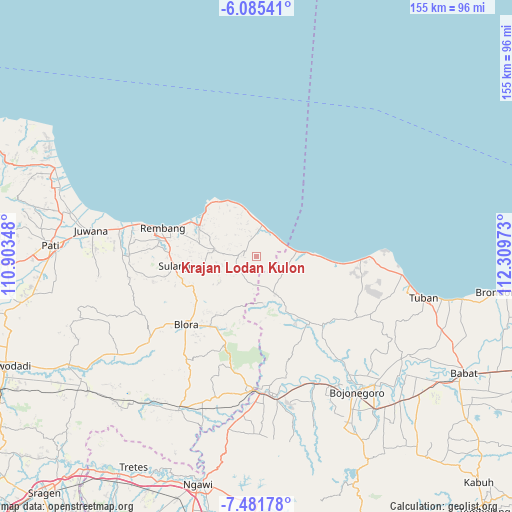
Krajan Lodan Kulon GPS coordinates[2]
6° 47' 2.76" South, 111° 36' 23.76" East
| Map corner | latitude | longitude |
|---|---|---|
| Upper-left | -6.08541°, | 110.90348° |
| Center: | -6.7841°, | 111.6066° |
| Lower-right: | -7.48178°, | 112.30973° |
| Map W x H: | 155.3×155.3 km | = 96.5×96.5mi |
| max Lat: | 5.88969° ⇑23.1% North |
| Krajan Lodan Kulon: | -6.7841° |
| min Lat: | ⇓76.9% South -10.934° |
| min Long | Krajan Lodan Ku | max Long |
| 95.1345° | 111.6066° | 140.9419° |
| W 44%⇐ | ⇒56% E |
Elevation
Elevation of Krajan Lodan Kulon is 38 m = 125 ft, and this is 191.7 m = 629 ft below average elevation for this country.
| Max E: |
3185 m = 10449 ft | 66.8% |
| Avg. | 229.7 m = 754 ft | |
| Krajan Lodan Kulon | 38 m = 125 ft | |
Min E: |
-1 m = -3 ft | 33.2% |
See also: Indonesia elevation on elevation.city.
Geographical zone
Krajan Lodan Kulon is located in South Torrid zone (between Equator and Tropic of Capricorn). Distance of Equator is 754.3 km =468.7 mi to North.| Distance of | km | miles | from Krajan Lodan Kulon |
|---|---|---|---|
| Equator | 754.3 | 468.7 | to North |
| Tropic Capricorn | 1851.6 | 1150.5 | to South |
| Antarctic Circle | 6646.9 | 4130.2 | to South |
| South Pole | 9252.7 | 5749.4 | to South |


Nearby cities:
15 places around Krajan Lodan Kulon: (largest is in red/bold)
• Babak
4.4 km =2.7 mi,  67°
67°
• Balongteki
4.4 km =2.7 mi,  15°
15°
• Gesikan
4 km =2.5 mi,  279°
279°
• Gobreh
3.4 km =2.1 mi,  336°
336°
• Karangasem
4.1 km =2.5 mi,  319°
319°
• Kedungdowo
4.1 km =2.5 mi,  305°
305°
• Krajanbonjor
3.6 km =2.2 mi,  89°
89°
• Krajandadapmulyo
5 km =3.1 mi,  37°
37°
• Lodan Wetan
0.3 km =0.2 mi,  123°
123°
• Mangseng
4.5 km =2.8 mi, 276°
• Nglojo
3.9 km =2.4 mi, 15°
• Sambirata
3.6 km =2.2 mi,  266°
266°
• Sedan
4 km =2.5 mi,  298°
298°
• Selo
2 km =1.2 mi,  9°
9°
• Tanggulangin
2.5 km =1.6 mi, 17°
Sources, notices
• [Note1] Compared only with cities in Indonesia existing in our database
• [Src1] Map data: © OpenStreetMap contributors (CC-BY-SA)
• [Src2] Other city data from geonames.org with taken over terms of usage.
• [Src3] Geographical zone / Annual Mean Temperature by Robert A. Rohde @ Wikipedia
