Krajandadapmulyo geodata
Krajandadapmulyo (Central Java) is a seat of a fourth-order administrative division; located in Indonesia in Asia/Jakarta (GMT+7) time zone. In our database, there are 407 cities with bigger population. Compared to other cities in Indonesia, 78.3% of cities are located further ↓South; 55.6% of cities are located further →East and 80.9% of cities have higher elevation than Krajandadapmulyo. Note1


Krajandadapmulyo GPS coordinates[2]
6° 44' 54.6" South, 111° 38' 3.12" East
| Map corner | latitude | longitude |
|---|---|---|
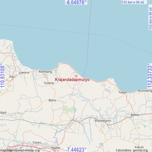
| Upper-left | -6.04976°, | 110.93108° |
| Center: | -6.7485°, | 111.6342° |
| Lower-right: | -7.44623°, | 112.33733° |
| Map W x H: | 155.3×155.3 km | = 96.5×96.5mi |
| max Lat: | 5.88969° ⇑21.7% North |
| Krajandadapmulyo: | -6.7485° |
| min Lat: | ⇓78.3% South -10.934° |
| min Long | Krajandadapmuly | max Long |
| 95.1345° | 111.6342° | 140.9419° |
| W 44.4%⇐ | ⇒55.6% E |
Elevation
Elevation of Krajandadapmulyo is 18 m = 59 ft, and this is 211.7 m = 695 ft below average elevation for this country.
| Max E: |
3185 m = 10449 ft | 80.9% |
| Avg. | 229.7 m = 754 ft | |
| Krajandadapmulyo | 18 m = 59 ft | |
Min E: |
-1 m = -3 ft | 19.1% |
See also: Indonesia elevation on elevation.city.
Geographical zone
Krajandadapmulyo is located in South Torrid zone (between Equator and Tropic of Capricorn). Distance of Equator is 750.4 km =466.3 mi to North.| Distance of | km | miles | from Krajandadapmulyo |
|---|---|---|---|
| Equator | 750.4 | 466.3 | to North |
| Tropic Capricorn | 1855.6 | 1153 | to South |
| Antarctic Circle | 6650.8 | 4132.6 | to South |
| South Pole | 9256.7 | 5751.8 | to South |


Nearby cities:
15 places around Krajandadapmulyo: (largest is in red/bold)
• Babak
2.5 km =1.6 mi,  156°
156°
• Bajingjowo
4.1 km =2.5 mi,  78°
78°
• Balongteki
1.9 km =1.2 mi,  279°
279°
• Banowan
3.4 km =2.1 mi,  105°
105°
• Gonggang
1.5 km =0.9 mi,  343°
343°
• Kalipang
3.5 km =2.2 mi,  38°
38°
• Krajanbaturno
2.7 km =1.7 mi,  135°
135°
• Krajanbonjor
4 km =2.5 mi,  171°
171°
• Mojokerto
3.3 km =2.1 mi,  301°
301°
• Ngilengan
2.9 km =1.8 mi,  357°
357°
• Nglojo
2 km =1.2 mi,  264°
264°
• Sarangmeduro
4.1 km =2.5 mi,  71°
71°
• Selo
3.4 km =2.1 mi,  233°
233°
• Sendangmulyo
3.9 km =2.4 mi, 71°
• Tanggulangin
2.8 km =1.7 mi,  235°
235°
Sources, notices
• [Note1] Compared only with cities in Indonesia existing in our database
• [Src1] Map data: © OpenStreetMap contributors (CC-BY-SA)
• [Src2] Other city data from geonames.org with taken over terms of usage.
• [Src3] Geographical zone / Annual Mean Temperature by Robert A. Rohde @ Wikipedia
