Nglojo geodata
Nglojo (Central Java) is a seat of a fourth-order administrative division; located in Indonesia in Asia/Jakarta (GMT+7) time zone. In our database, there are 407 cities with bigger population. Compared to other cities in Indonesia, 78.2% of cities are located further ↓South; 55.8% of cities are located further →East and 78.9% of cities have higher elevation than Nglojo. Note1


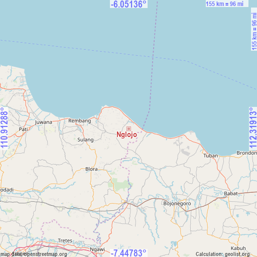
Nglojo GPS coordinates[2]
6° 45' 0.36" South, 111° 36' 57.6" East
| Map corner | latitude | longitude |
|---|---|---|
| Upper-left | -6.05136°, | 110.91288° |
| Center: | -6.7501°, | 111.616° |
| Lower-right: | -7.44783°, | 112.31913° |
| Map W x H: | 155.3×155.3 km | = 96.5×96.5mi |
| max Lat: | 5.88969° ⇑21.8% North |
| Nglojo: | -6.7501° |
| min Lat: | ⇓78.2% South -10.934° |
| min Long | Nglojo | max Long |
| 95.1345° | 111.616° | 140.9419° |
| W 44.2%⇐ | ⇒55.8% E |
Elevation
Elevation of Nglojo is 20 m = 66 ft, and this is 209.7 m = 688 ft below average elevation for this country.
| Max E: |
3185 m = 10449 ft | 78.9% |
| Avg. | 229.7 m = 754 ft | |
| Nglojo | 20 m = 66 ft | |
Min E: |
-1 m = -3 ft | 21.1% |
See also: Indonesia elevation on elevation.city.
Geographical zone
Nglojo is located in South Torrid zone (between Equator and Tropic of Capricorn). Distance of Equator is 750.5 km =466.3 mi to North.| Distance of | km | miles | from Nglojo |
|---|---|---|---|
| Equator | 750.5 | 466.3 | to North |
| Tropic Capricorn | 1855.4 | 1152.9 | to South |
| Antarctic Circle | 6650.6 | 4132.5 | to South |
| South Pole | 9256.5 | 5751.7 | to South |


Nearby cities:
15 places around Nglojo: (largest is in red/bold)
• Babak
3.7 km =2.3 mi,  124°
124°
• Balongteki
0.5 km =0.3 mi,  17°
17°
• Gobreh
2.5 km =1.6 mi,  254°
254°
• Gonggang
2.2 km =1.4 mi,  44°
44°
• Karangasem
3.8 km =2.4 mi,  260°
260°
• Kedungringin
3.7 km =2.3 mi,  289°
289°
• Krajan Lodan Kulon
3.9 km =2.4 mi,  195°
195°
• Krajanbaturno
4.2 km =2.6 mi,  114°
114°
• Krajandadapmulyo
2 km =1.2 mi,  84°
84°
• Lodan Wetan
4 km =2.5 mi,  191°
191°
• Menara
3.6 km =2.2 mi,  312°
312°
• Mojokerto
2 km =1.2 mi,  337°
337°
• Ngilengan
3.6 km =2.2 mi,  31°
31°
• Selo
1.9 km =1.2 mi, 201°
• Tanggulangin
1.4 km =0.9 mi, 191°
Sources, notices
• [Note1] Compared only with cities in Indonesia existing in our database
• [Src1] Map data: © OpenStreetMap contributors (CC-BY-SA)
• [Src2] Other city data from geonames.org with taken over terms of usage.
• [Src3] Geographical zone / Annual Mean Temperature by Robert A. Rohde @ Wikipedia
