Kebonharjo geodata
Kebonharjo (East Java) is a seat of a fourth-order administrative division; located in Indonesia in Asia/Jakarta (GMT+7) time zone. In our database, there are 407 cities with bigger population. Compared to other cities in Indonesia, 74.5% of cities are located further ↓South; 55.8% of cities are located further →East and 55.5% of cities have higher elevation than Kebonharjo. Note1


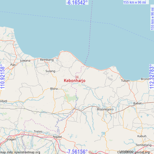
Kebonharjo GPS coordinates[2]
6° 51' 50.4" South, 111° 37' 28.92" East
| Map corner | latitude | longitude |
|---|---|---|
| Upper-left | -6.16542°, | 110.92158° |
| Center: | -6.864°, | 111.6247° |
| Lower-right: | -7.56156°, | 112.32783° |
| Map W x H: | 155.2×155.2 km | = 96.4×96.4mi |
| max Lat: | 5.88969° ⇑25.5% North |
| Kebonharjo: | -6.864° |
| min Lat: | ⇓74.5% South -10.934° |
| min Long | Kebonharjo | max Long |
| 95.1345° | 111.6247° | 140.9419° |
| W 44.2%⇐ | ⇒55.8% E |
Elevation
Elevation of Kebonharjo is 82 m = 269 ft, and this is 147.7 m = 485 ft below average elevation for this country.
| Max E: |
3185 m = 10449 ft | 55.5% |
| Avg. | 229.7 m = 754 ft | |
| Kebonharjo | 82 m = 269 ft | |
Min E: |
-1 m = -3 ft | 44.5% |
See also: Indonesia elevation on elevation.city.
Geographical zone
Kebonharjo is located in South Torrid zone (between Equator and Tropic of Capricorn). Distance of Equator is 763.2 km =474.2 mi to North.| Distance of | km | miles | from Kebonharjo |
|---|---|---|---|
| Equator | 763.2 | 474.2 | to North |
| Tropic Capricorn | 1842.7 | 1145 | to South |
| Antarctic Circle | 6638 | 4124.7 | to South |
| South Pole | 9243.9 | 5743.9 | to South |


Nearby cities:
15 places around Kebonharjo: (largest is in red/bold)
• Bader
3.4 km =2.1 mi,  95°
95°
• Bancang
3.7 km =2.3 mi,  230°
230°
• Besowo
3.7 km =2.3 mi,  66°
66°
• Jatirogo
4.5 km =2.8 mi,  122°
122°
• Joho
4.3 km =2.7 mi,  266°
266°
• Jombok
3.1 km =1.9 mi,  131°
131°
• Karangtengah
1.9 km =1.2 mi,  153°
153°
• Ketodan
2.5 km =1.6 mi,  50°
50°
• Krajan Sale
2 km =1.2 mi,  277°
277°
• Mrayun
4.3 km =2.7 mi,  251°
251°
• Paseyan
2.2 km =1.4 mi, 124°
• Sadang
4.4 km =2.7 mi,  108°
108°
• Sale
2.3 km =1.4 mi, 275°
• Wangi
1.2 km =0.7 mi,  38°
38°
• Wotsogo
4.3 km =2.7 mi, 131°
Sources, notices
• [Note1] Compared only with cities in Indonesia existing in our database
• [Src1] Map data: © OpenStreetMap contributors (CC-BY-SA)
• [Src2] Other city data from geonames.org with taken over terms of usage.
• [Src3] Geographical zone / Annual Mean Temperature by Robert A. Rohde @ Wikipedia
