Joho geodata
Joho (Central Java) is a seat of a fourth-order administrative division; located in Indonesia in Asia/Jakarta (GMT+7) time zone. In our database, there are 407 cities with bigger population. Compared to other cities in Indonesia, 74.4% of cities are located further ↓South; 56.4% of cities are located further →East and 52.5% of cities have lower elevation than Joho. Note1


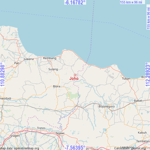
Joho GPS coordinates[2]
6° 51' 59.04" South, 111° 35' 9.96" East
| Map corner | latitude | longitude |
|---|---|---|
| Upper-left | -6.16782°, | 110.88298° |
| Center: | -6.8664°, | 111.5861° |
| Lower-right: | -7.56395°, | 112.28923° |
| Map W x H: | 155.2×155.2 km | = 96.4×96.4mi |
| max Lat: | 5.88969° ⇑25.6% North |
| Joho: | -6.8664° |
| min Lat: | ⇓74.4% South -10.934° |
| min Long | Joho | max Long |
| 95.1345° | 111.5861° | 140.9419° |
| W 43.6%⇐ | ⇒56.4% E |
Elevation
Elevation of Joho is 112 m = 367 ft, and this is 117.7 m = 386 ft below average elevation for this country.
| Max E: |
3185 m = 10449 ft | 47.5% |
| Avg. | 229.7 m = 754 ft | |
| Joho | 112 m = 367 ft | |
Min E: |
-1 m = -3 ft | 52.5% |
See also: Indonesia elevation on elevation.city.
Geographical zone
Joho is located in South Torrid zone (between Equator and Tropic of Capricorn). Distance of Equator is 763.5 km =474.4 mi to North.| Distance of | km | miles | from Joho |
|---|---|---|---|
| Equator | 763.5 | 474.4 | to North |
| Tropic Capricorn | 1842.4 | 1144.8 | to South |
| Antarctic Circle | 6637.7 | 4124.5 | to South |
| South Pole | 9243.6 | 5743.7 | to South |


Nearby cities:
15 places around Joho: (largest is in red/bold)
• Bancang
2.5 km =1.6 mi,  145°
145°
• Gading Barat
3.3 km =2.1 mi,  241°
241°
• Jinanten
1.8 km =1.1 mi,  234°
234°
• Kaliprak
2.2 km =1.4 mi,  188°
188°
• Karangtengah
5.3 km =3.3 mi,  105°
105°
• Kebonharjo
4.3 km =2.7 mi,  86°
86°
• Krajan Sale
2.3 km =1.4 mi,  77°
77°
• Mrayun
1.1 km =0.7 mi,  170°
170°
• Paseyan
6.2 km =3.9 mi,  99°
99°
• Sale
2.1 km =1.3 mi, 76°
• Tahunan
4.2 km =2.6 mi, 240°
• Tawaran
5.6 km =3.5 mi, 150°
• Tengger
5.7 km =3.5 mi,  304°
304°
• Wangi
5.1 km =3.2 mi, 76°
• Wonokerto
1.5 km =0.9 mi,  354°
354°
Sources, notices
• [Note1] Compared only with cities in Indonesia existing in our database
• [Src1] Map data: © OpenStreetMap contributors (CC-BY-SA)
• [Src2] Other city data from geonames.org with taken over terms of usage.
• [Src3] Geographical zone / Annual Mean Temperature by Robert A. Rohde @ Wikipedia
