Jlodro geodata
Jlodro (East Java) is a seat of a fourth-order administrative division; located in Indonesia in Asia/Jakarta (GMT+7) time zone. In our database, there are 407 cities with bigger population. Compared to other cities in Indonesia, 70.8% of cities are located further ↓South; 56.4% of cities are located further →East and 56.9% of cities have lower elevation than Jlodro. Note1


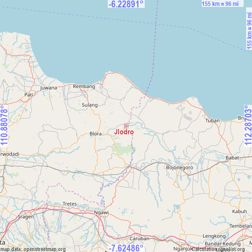
Jlodro GPS coordinates[2]
6° 55' 38.64" South, 111° 35' 2.04" East
| Map corner | latitude | longitude |
|---|---|---|
| Upper-left | -6.22891°, | 110.88078° |
| Center: | -6.9274°, | 111.5839° |
| Lower-right: | -7.62486°, | 112.28703° |
| Map W x H: | 155.2×155.2 km | = 96.4×96.4mi |
| max Lat: | 5.88969° ⇑29.2% North |
| Jlodro: | -6.9274° |
| min Lat: | ⇓70.8% South -10.934° |
| min Long | Jlodro | max Long |
| 95.1345° | 111.5839° | 140.9419° |
| W 43.6%⇐ | ⇒56.4% E |
Elevation
Elevation of Jlodro is 136 m = 446 ft, and this is 93.7 m = 307 ft below average elevation for this country.
| Max E: |
3185 m = 10449 ft | 43.1% |
| Avg. | 229.7 m = 754 ft | |
| Jlodro | 136 m = 446 ft | |
Min E: |
-1 m = -3 ft | 56.9% |
See also: Indonesia elevation on elevation.city.
Geographical zone
Jlodro is located in South Torrid zone (between Equator and Tropic of Capricorn). Distance of Equator is 770.3 km =478.6 mi to North.| Distance of | km | miles | from Jlodro |
|---|---|---|---|
| Equator | 770.3 | 478.6 | to North |
| Tropic Capricorn | 1835.7 | 1140.7 | to South |
| Antarctic Circle | 6630.9 | 4120.2 | to South |
| South Pole | 9236.8 | 5739.5 | to South |


Nearby cities:
15 places around Jlodro: (largest is in red/bold)
• Bancang
5 km =3.1 mi,  19°
19°
• Blimbing
5.6 km =3.5 mi,  288°
288°
• Gading Barat
5.9 km =3.7 mi,  333°
333°
• Gayamdesa
4.7 km =2.9 mi,  272°
272°
• Gembol
5.5 km =3.4 mi,  246°
246°
• Jetis
5 km =3.1 mi,  70°
70°
• Jinanten
5.9 km =3.7 mi,  348°
348°
• Kaliprak
4.6 km =2.9 mi,  358°
358°
• Ketringan
4.6 km =2.9 mi,  214°
214°
• Krajan Jamprong
5.1 km =3.2 mi,  136°
136°
• Mrayun
5.7 km =3.5 mi,  4°
4°
• Sendangrejo
2.9 km =1.8 mi, 288°
• Sukogunungkrajan
1.9 km =1.2 mi, 138°
• Tahunan
5.8 km =3.6 mi,  324°
324°
• Tawaran
3.6 km =2.2 mi,  56°
56°
Sources, notices
• [Note1] Compared only with cities in Indonesia existing in our database
• [Src1] Map data: © OpenStreetMap contributors (CC-BY-SA)
• [Src2] Other city data from geonames.org with taken over terms of usage.
• [Src3] Geographical zone / Annual Mean Temperature by Robert A. Rohde @ Wikipedia
