Krajan Jamprong geodata
Krajan Jamprong (East Java) is a seat of a fourth-order administrative division; located in Indonesia in Asia/Jakarta (GMT+7) time zone. In our database, there are 407 cities with bigger population. Compared to other cities in Indonesia, 69% of cities are located further ↓South; 55.8% of cities are located further →East and 65.9% of cities have lower elevation than Krajan Jamprong. Note1


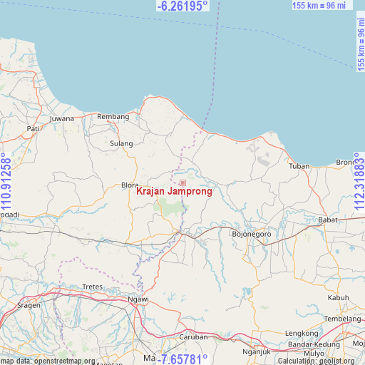
Krajan Jamprong GPS coordinates[2]
6° 57' 37.44" South, 111° 36' 56.52" East
| Map corner | latitude | longitude |
|---|---|---|
| Upper-left | -6.26195°, | 110.91258° |
| Center: | -6.9604°, | 111.6157° |
| Lower-right: | -7.65781°, | 112.31883° |
| Map W x H: | 155.2×155.2 km | = 96.4×96.4mi |
| max Lat: | 5.88969° ⇑31% North |
| Krajan Jamprong: | -6.9604° |
| min Lat: | ⇓69% South -10.934° |
| min Long | Krajan Jamprong | max Long |
| 95.1345° | 111.6157° | 140.9419° |
| W 44.2%⇐ | ⇒55.8% E |
Elevation
Elevation of Krajan Jamprong is 236 m = 774 ft, and this is 6.3 m = 21 ft above average elevation for this country.
| Max E: |
3185 m = 10449 ft | 34.1% |
| Krajan Jamprong | 236 m 774 ft | |
| Avg. | 229.7 m = 754 ft | |
Min E: |
-1 m = -3 ft | 65.9% |
See also: Indonesia elevation on elevation.city.
Geographical zone
Krajan Jamprong is located in South Torrid zone (between Equator and Tropic of Capricorn). Distance of Equator is 773.9 km =480.9 mi to North.| Distance of | km | miles | from Krajan Jamprong |
|---|---|---|---|
| Equator | 773.9 | 480.9 | to North |
| Tropic Capricorn | 1832 | 1138.4 | to South |
| Antarctic Circle | 6627.3 | 4118 | to South |
| South Pole | 9233.1 | 5737.2 | to South |


Nearby cities:
15 places around Krajan Jamprong: (largest is in red/bold)
• Balong
7.2 km =4.5 mi,  41°
41°
• Bancang
8.6 km =5.3 mi,  347°
347°
• Gembol
8.7 km =5.4 mi,  280°
280°
• Jetis
5.5 km =3.4 mi,  12°
12°
• Jlodro
5.1 km =3.2 mi,  316°
316°
• Karanggeneng
6.7 km =4.2 mi,  68°
68°
• Kejuron
7.8 km =4.8 mi,  98°
98°
• Ketringan
6.1 km =3.8 mi,  268°
268°
• Klakeh
7.9 km =4.9 mi, 104°
• Muruni
8.5 km =5.3 mi,  51°
51°
• Ngancar
7.2 km =4.5 mi, 53°
• Nglateng Barat
3.2 km =2 mi,  79°
79°
• Sendangrejo
7.8 km =4.8 mi,  306°
306°
• Sukogunungkrajan
3.2 km =2 mi, 314°
• Tawaran
5.6 km =3.5 mi, 354°
Sources, notices
• [Note1] Compared only with cities in Indonesia existing in our database
• [Src1] Map data: © OpenStreetMap contributors (CC-BY-SA)
• [Src2] Other city data from geonames.org with taken over terms of usage.
• [Src3] Geographical zone / Annual Mean Temperature by Robert A. Rohde @ Wikipedia
