Ngujuran geodata
Ngujuran (East Java) is a seat of a fourth-order administrative division; located in Indonesia in Asia/Jakarta (GMT+7) time zone. In our database, there are 407 cities with bigger population. Compared to other cities in Indonesia, 75.5% of cities are located further ↓South; 54.6% of cities are located further →East and 62.1% of cities have higher elevation than Ngujuran. Note1


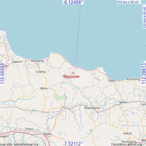
Ngujuran GPS coordinates[2]
6° 49' 24.6" South, 111° 41' 34.8" East
| Map corner | latitude | longitude |
|---|---|---|
| Upper-left | -6.12486°, | 110.98988° |
| Center: | -6.8235°, | 111.693° |
| Lower-right: | -7.52112°, | 112.39613° |
| Map W x H: | 155.2×155.3 km | = 96.4×96.5mi |
| max Lat: | 5.88969° ⇑24.5% North |
| Ngujuran: | -6.8235° |
| min Lat: | ⇓75.5% South -10.934° |
| min Long | Ngujuran | max Long |
| 95.1345° | 111.693° | 140.9419° |
| W 45.4%⇐ | ⇒54.6% E |
Elevation
Elevation of Ngujuran is 51 m = 167 ft, and this is 178.7 m = 586 ft below average elevation for this country.
| Max E: |
3185 m = 10449 ft | 62.1% |
| Avg. | 229.7 m = 754 ft | |
| Ngujuran | 51 m = 167 ft | |
Min E: |
-1 m = -3 ft | 37.9% |
See also: Indonesia elevation on elevation.city.
Geographical zone
Ngujuran is located in South Torrid zone (between Equator and Tropic of Capricorn). Distance of Equator is 758.7 km =471.4 mi to North.| Distance of | km | miles | from Ngujuran |
|---|---|---|---|
| Equator | 758.7 | 471.4 | to North |
| Tropic Capricorn | 1847.2 | 1147.8 | to South |
| Antarctic Circle | 6642.5 | 4127.5 | to South |
| South Pole | 9248.4 | 5746.7 | to South |


Nearby cities:
15 places around Ngujuran: (largest is in red/bold)
• Besowo
5.1 km =3.2 mi,  233°
233°
• Dukuhdukuhan
5.5 km =3.4 mi,  153°
153°
• Jahulu
6 km =3.7 mi,  76°
76°
• Jatisari
5.1 km =3.2 mi,  92°
92°
• Kayen
5.3 km =3.3 mi, 92°
• Kelabang
6.2 km =3.9 mi,  38°
38°
• Ketodan
6.3 km =3.9 mi,  242°
242°
• Krojo
4.1 km =2.5 mi,  189°
189°
• Latsari
5 km =3.1 mi,  358°
358°
• Sampung
6.3 km =3.9 mi,  314°
314°
• Siding
5 km =3.1 mi,  57°
57°
• Tawangrejo
5.7 km =3.5 mi, 306°
• Tengger
3.7 km =2.3 mi,  33°
33°
• Tlogoagung
5.7 km =3.5 mi,  333°
333°
• Weden
1.7 km =1.1 mi,  247°
247°
Sources, notices
• [Note1] Compared only with cities in Indonesia existing in our database
• [Src1] Map data: © OpenStreetMap contributors (CC-BY-SA)
• [Src2] Other city data from geonames.org with taken over terms of usage.
• [Src3] Geographical zone / Annual Mean Temperature by Robert A. Rohde @ Wikipedia
