Laju Kidul geodata
Laju Kidul (East Java) is a seat of a fourth-order administrative division; located in Indonesia in Asia/Jakarta (GMT+7) time zone. In our database, there are 407 cities with bigger population. Compared to other cities in Indonesia, 68.3% of cities are located further ↓South; 53.5% of cities are located further →East and 63.8% of cities have higher elevation than Laju Kidul. Note1


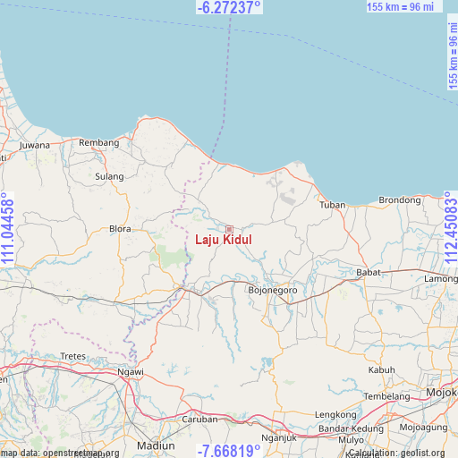
Laju Kidul GPS coordinates[2]
6° 58' 14.88" South, 111° 44' 51.72" East
| Map corner | latitude | longitude |
|---|---|---|
| Upper-left | -6.27237°, | 111.04458° |
| Center: | -6.9708°, | 111.7477° |
| Lower-right: | -7.66819°, | 112.45083° |
| Map W x H: | 155.2×155.2 km | = 96.4×96.4mi |
| max Lat: | 5.88969° ⇑31.7% North |
| Laju Kidul: | -6.9708° |
| min Lat: | ⇓68.3% South -10.934° |
| min Long | Laju Kidul | max Long |
| 95.1345° | 111.7477° | 140.9419° |
| W 46.5%⇐ | ⇒53.5% E |
Elevation
Elevation of Laju Kidul is 46 m = 151 ft, and this is 183.7 m = 603 ft below average elevation for this country.
| Max E: |
3185 m = 10449 ft | 63.8% |
| Avg. | 229.7 m = 754 ft | |
| Laju Kidul | 46 m = 151 ft | |
Min E: |
-1 m = -3 ft | 36.2% |
See also: Indonesia elevation on elevation.city.
Geographical zone
Laju Kidul is located in South Torrid zone (between Equator and Tropic of Capricorn). Distance of Equator is 775.1 km =481.6 mi to North.| Distance of | km | miles | from Laju Kidul |
|---|---|---|---|
| Equator | 775.1 | 481.6 | to North |
| Tropic Capricorn | 1830.8 | 1137.6 | to South |
| Antarctic Circle | 6626.1 | 4117.3 | to South |
| South Pole | 9232 | 5736.5 | to South |


Nearby cities:
15 places around Laju Kidul: (largest is in red/bold)
• Bangilan
3.7 km =2.3 mi,  271°
271°
• Banjarworo
4 km =2.5 mi,  298°
298°
• Jojogan
4.5 km =2.8 mi,  90°
90°
• Kablukan
4.5 km =2.8 mi,  250°
250°
• Kedungharjo
2.8 km =1.7 mi, 254°
• Kedungmulyo
3.5 km =2.2 mi, 296°
• Krajan Weden
3 km =1.9 mi, 250°
• Mulyoagung
4.5 km =2.8 mi,  81°
81°
• Mundri
4.5 km =2.8 mi,  291°
291°
• Ngrojo
3.6 km =2.2 mi, 250°
• Sendang
4.4 km =2.7 mi,  205°
205°
• Sumuragung
3.9 km =2.4 mi,  281°
281°
• Talok
4.2 km =2.6 mi,  259°
259°
• Tanggir Timur
1.7 km =1.1 mi,  132°
132°
• Tawangsari
4.1 km =2.5 mi, 133°
Sources, notices
• [Note1] Compared only with cities in Indonesia existing in our database
• [Src1] Map data: © OpenStreetMap contributors (CC-BY-SA)
• [Src2] Other city data from geonames.org with taken over terms of usage.
• [Src3] Geographical zone / Annual Mean Temperature by Robert A. Rohde @ Wikipedia
