Sendang geodata
Sendang (East Java) is a seat of a fourth-order administrative division; located in Indonesia in Asia/Jakarta (GMT+7) time zone. In our database, there are 407 cities with bigger population. Compared to other cities in Indonesia, 65.4% of cities are located further ↓South; 53.9% of cities are located further →East and 63.5% of cities have higher elevation than Sendang. Note1


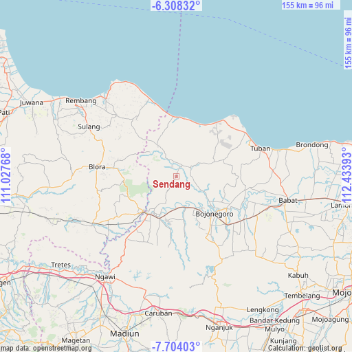
Sendang GPS coordinates[2]
7° 0' 24.12" South, 111° 43' 50.88" East
| Map corner | latitude | longitude |
|---|---|---|
| Upper-left | -6.30832°, | 111.02768° |
| Center: | -7.0067°, | 111.7308° |
| Lower-right: | -7.70403°, | 112.43393° |
| Map W x H: | 155.2×155.2 km | = 96.4×96.4mi |
| max Lat: | 5.88969° ⇑34.6% North |
| Sendang: | -7.0067° |
| min Lat: | ⇓65.4% South -10.934° |
| min Long | Sendang | max Long |
| 95.1345° | 111.7308° | 140.9419° |
| W 46.1%⇐ | ⇒53.9% E |
Elevation
Elevation of Sendang is 47 m = 154 ft, and this is 182.7 m = 599 ft below average elevation for this country.
| Max E: |
3185 m = 10449 ft | 63.5% |
| Avg. | 229.7 m = 754 ft | |
| Sendang | 47 m = 154 ft | |
Min E: |
-1 m = -3 ft | 36.5% |
See also: Indonesia elevation on elevation.city.
Geographical zone
Sendang is located in South Torrid zone (between Equator and Tropic of Capricorn). Distance of Equator is 779.1 km =484.1 mi to North.| Distance of | km | miles | from Sendang |
|---|---|---|---|
| Equator | 779.1 | 484.1 | to North |
| Tropic Capricorn | 1826.8 | 1135.1 | to South |
| Antarctic Circle | 6622.1 | 4114.8 | to South |
| South Pole | 9228 | 5734 | to South |


Nearby cities:
15 places around Sendang: (largest is in red/bold)
• Banaran
3.7 km =2.3 mi,  166°
166°
• Bangilan
4.5 km =2.8 mi,  335°
335°
• Kablukan
3.4 km =2.1 mi,  316°
316°
• Kedungharjo
3.3 km =2.1 mi,  345°
345°
• Krajan Weden
3.1 km =1.9 mi, 342°
• Laju Kidul
4.4 km =2.7 mi,  25°
25°
• Leran
2.2 km =1.4 mi,  217°
217°
• Medalem
1.9 km =1.2 mi,  284°
284°
• Ngrojo
3.2 km =2 mi,  331°
331°
• Sarang
4.3 km =2.7 mi,  230°
230°
• Senori
1.2 km =0.7 mi, 215°
• Talok
3.9 km =2.4 mi, 325°
• Tanggir Timur
4.2 km =2.6 mi,  47°
47°
• Wanglu Kulon
1.4 km =0.9 mi,  177°
177°
• Wanglu Wetan
2 km =1.2 mi, 172°
Sources, notices
• [Note1] Compared only with cities in Indonesia existing in our database
• [Src1] Map data: © OpenStreetMap contributors (CC-BY-SA)
• [Src2] Other city data from geonames.org with taken over terms of usage.
• [Src3] Geographical zone / Annual Mean Temperature by Robert A. Rohde @ Wikipedia
