Dukuhkopi geodata
Dukuhkopi (Central Java) is a seat of a fourth-order administrative division; located in Indonesia in Asia/Jakarta (GMT+7) time zone. In our database, there are 407 cities with bigger population. Compared to other cities in Indonesia, 65% of cities are located further ↓South; 67.4% of cities are located further →East and 68.4% of cities have higher elevation than Dukuhkopi. Note1


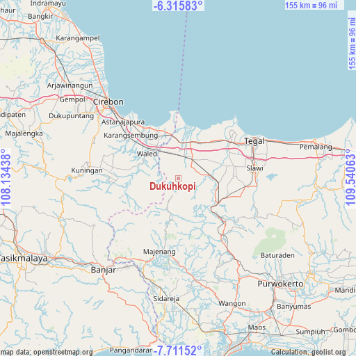
Dukuhkopi GPS coordinates[2]
7° 0' 51.12" South, 108° 50' 15" East
| Map corner | latitude | longitude |
|---|---|---|
| Upper-left | -6.31583°, | 108.13438° |
| Center: | -7.0142°, | 108.8375° |
| Lower-right: | -7.71152°, | 109.54063° |
| Map W x H: | 155.2×155.2 km | = 96.4×96.4mi |
| max Lat: | 5.88969° ⇑35% North |
| Dukuhkopi: | -7.0142° |
| min Lat: | ⇓65% South -10.934° |
| min Long | Dukuhkopi | max Long |
| 95.1345° | 108.8375° | 140.9419° |
| W 32.6%⇐ | ⇒67.4% E |
Elevation
Elevation of Dukuhkopi is 35 m = 115 ft, and this is 194.7 m = 639 ft below average elevation for this country.
| Max E: |
3185 m = 10449 ft | 68.4% |
| Avg. | 229.7 m = 754 ft | |
| Dukuhkopi | 35 m = 115 ft | |
Min E: |
-1 m = -3 ft | 31.6% |
See also: Indonesia elevation on elevation.city.
Geographical zone
Dukuhkopi is located in South Torrid zone (between Equator and Tropic of Capricorn). Distance of Equator is 779.9 km =484.6 mi to North.| Distance of | km | miles | from Dukuhkopi |
|---|---|---|---|
| Equator | 779.9 | 484.6 | to North |
| Tropic Capricorn | 1826 | 1134.6 | to South |
| Antarctic Circle | 6621.3 | 4114.3 | to South |
| South Pole | 9227.2 | 5733.5 | to South |


Nearby cities:
15 places around Dukuhkopi: (largest is in red/bold)
• Bandungsari
7.2 km =4.5 mi,  195°
195°
• Bantarpanjang
7.9 km =4.9 mi,  276°
276°
• Blandongan
8.3 km =5.2 mi,  179°
179°
• Cibingbin
9.8 km =6.1 mi,  237°
237°
• Cipanjang
6.3 km =3.9 mi,  206°
206°
• Cisaat
10.2 km =6.3 mi,  256°
256°
• Citenjo
9.6 km =6 mi,  249°
249°
• Dukuhbadag
9 km =5.6 mi, 261°
• Kertasari
6.1 km =3.8 mi,  188°
188°
• Ketanggungan
10.3 km =6.4 mi,  34°
34°
• Kliwon Cibingbin
9.9 km =6.2 mi, 240°
• Melahayu
1.8 km =1.1 mi,  221°
221°
• Pamedaran
6.7 km =4.2 mi,  153°
153°
• Penanggapan
7.8 km =4.8 mi,  225°
225°
• Sindangheula
8.7 km =5.4 mi, 199°
Sources, notices
• [Note1] Compared only with cities in Indonesia existing in our database
• [Src1] Map data: © OpenStreetMap contributors (CC-BY-SA)
• [Src2] Other city data from geonames.org with taken over terms of usage.
• [Src3] Geographical zone / Annual Mean Temperature by Robert A. Rohde @ Wikipedia
