Takerharjo geodata
Takerharjo (East Java) is a seat of a fourth-order administrative division; located in Indonesia in Asia/Jakarta (GMT+7) time zone. In our database, there are 407 cities with bigger population. Compared to other cities in Indonesia, 70.1% of cities are located further ↓South; 53.5% of cities are located further ←West and 58.2% of cities have higher elevation than Takerharjo. Note1


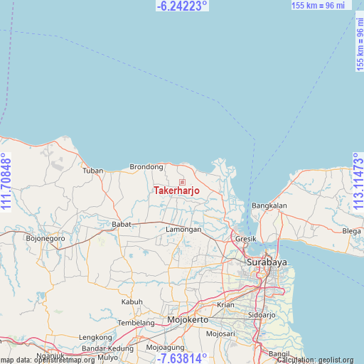
Takerharjo GPS coordinates[2]
6° 56' 26.52" South, 112° 24' 41.76" East
| Map corner | latitude | longitude |
|---|---|---|
| Upper-left | -6.24223°, | 111.70848° |
| Center: | -6.9407°, | 112.4116° |
| Lower-right: | -7.63814°, | 113.11473° |
| Map W x H: | 155.2×155.2 km | = 96.4×96.4mi |
| max Lat: | 5.88969° ⇑29.9% North |
| Takerharjo: | -6.9407° |
| min Lat: | ⇓70.1% South -10.934° |
| min Long | Takerharjo | max Long |
| 95.1345° | 112.4116° | 140.9419° |
| W 53.5%⇐ | ⇒46.5% E |
Elevation
Elevation of Takerharjo is 67 m = 220 ft, and this is 162.7 m = 534 ft below average elevation for this country.
| Max E: |
3185 m = 10449 ft | 58.2% |
| Avg. | 229.7 m = 754 ft | |
| Takerharjo | 67 m = 220 ft | |
Min E: |
-1 m = -3 ft | 41.8% |
See also: Indonesia elevation on elevation.city.
Geographical zone
Takerharjo is located in South Torrid zone (between Equator and Tropic of Capricorn). Distance of Equator is 771.7 km =479.5 mi to North.| Distance of | km | miles | from Takerharjo |
|---|---|---|---|
| Equator | 771.7 | 479.5 | to North |
| Tropic Capricorn | 1834.2 | 1139.7 | to South |
| Antarctic Circle | 6629.4 | 4119.3 | to South |
| South Pole | 9235.3 | 5738.5 | to South |


Nearby cities:
15 places around Takerharjo: (largest is in red/bold)
• Bangeran
4.6 km =2.9 mi,  189°
189°
• Banyubang
1.7 km =1.1 mi,  12°
12°
• Bluri
3.1 km =1.9 mi,  18°
18°
• Bulangan
4.8 km =3 mi,  207°
207°
• Dagan
2.7 km =1.7 mi,  0°
0°
• Gampeng
4.6 km =2.9 mi,  84°
84°
• Jetis
4.7 km =2.9 mi,  150°
150°
• Ketanen
3.7 km =2.3 mi,  62°
62°
• Lowayu
3.8 km =2.4 mi,  167°
167°
• Pantenan
3.7 km =2.3 mi,  51°
51°
• Serah
3.7 km =2.3 mi,  104°
104°
• Siwalan
2.5 km =1.6 mi,  85°
85°
• Sumurber
2.1 km =1.3 mi,  117°
117°
• Watuguling
5.2 km =3.2 mi, 61°
• Wonokerto
3.5 km =2.2 mi, 206°
Sources, notices
• [Note1] Compared only with cities in Indonesia existing in our database
• [Src1] Map data: © OpenStreetMap contributors (CC-BY-SA)
• [Src2] Other city data from geonames.org with taken over terms of usage.
• [Src3] Geographical zone / Annual Mean Temperature by Robert A. Rohde @ Wikipedia
