Lowayu geodata
Lowayu (East Java) is a seat of a fourth-order administrative division; located in Indonesia in Asia/Jakarta (GMT+7) time zone. In our database, there are 407 cities with bigger population. Compared to other cities in Indonesia, 68.1% of cities are located further ↓South; 53.6% of cities are located further ←West and 86.4% of cities have higher elevation than Lowayu. Note1


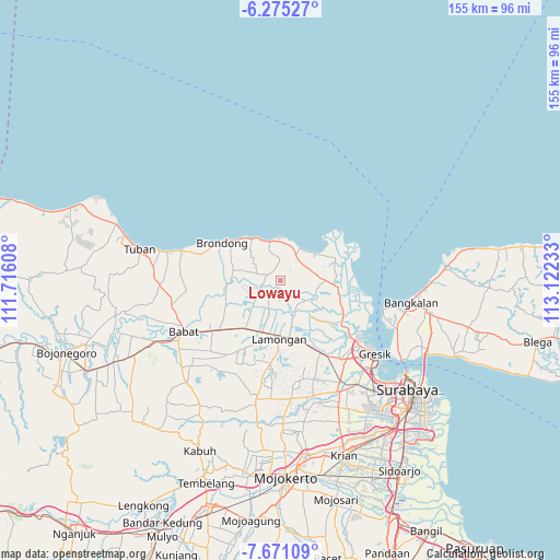
Lowayu GPS coordinates[2]
6° 58' 25.32" South, 112° 25' 9.12" East
| Map corner | latitude | longitude |
|---|---|---|
| Upper-left | -6.27527°, | 111.71608° |
| Center: | -6.9737°, | 112.4192° |
| Lower-right: | -7.67109°, | 113.12233° |
| Map W x H: | 155.2×155.2 km | = 96.4×96.4mi |
| max Lat: | 5.88969° ⇑31.9% North |
| Lowayu: | -6.9737° |
| min Lat: | ⇓68.1% South -10.934° |
| min Long | Lowayu | max Long |
| 95.1345° | 112.4192° | 140.9419° |
| W 53.6%⇐ | ⇒46.4% E |
Elevation
Elevation of Lowayu is 13 m = 43 ft, and this is 216.7 m = 711 ft below average elevation for this country.
| Max E: |
3185 m = 10449 ft | 86.4% |
| Avg. | 229.7 m = 754 ft | |
| Lowayu | 13 m = 43 ft | |
Min E: |
-1 m = -3 ft | 13.6% |
See also: Indonesia elevation on elevation.city.
Geographical zone
Lowayu is located in South Torrid zone (between Equator and Tropic of Capricorn). Distance of Equator is 775.4 km =481.8 mi to North.| Distance of | km | miles | from Lowayu |
|---|---|---|---|
| Equator | 775.4 | 481.8 | to North |
| Tropic Capricorn | 1830.5 | 1137.4 | to South |
| Antarctic Circle | 6625.8 | 4117.1 | to South |
| South Pole | 9231.7 | 5736.3 | to South |


Nearby cities:
15 places around Lowayu: (largest is in red/bold)
• Bangeran
1.8 km =1.1 mi,  240°
240°
• Bulangan
3.1 km =1.9 mi,  259°
259°
• Butungan
3.6 km =2.2 mi,  231°
231°
• Canditunggal
3.1 km =1.9 mi,  178°
178°
• Jetis
1.5 km =0.9 mi,  106°
106°
• Kalitengah
3.2 km =2 mi,  220°
220°
• Kediren
2.8 km =1.7 mi,  212°
212°
• Kuluran
2.8 km =1.7 mi,  196°
196°
• Mentaras
3.2 km =2 mi, 106°
• Serah
3.9 km =2.4 mi,  44°
44°
• Sumurber
2.9 km =1.8 mi,  21°
21°
• Takerharjo
3.8 km =2.4 mi,  347°
347°
• Tebuwung
2.4 km =1.5 mi, 110°
• Tiremenggal
2.8 km =1.7 mi,  163°
163°
• Wonokerto
2.5 km =1.6 mi,  283°
283°
Sources, notices
• [Note1] Compared only with cities in Indonesia existing in our database
• [Src1] Map data: © OpenStreetMap contributors (CC-BY-SA)
• [Src2] Other city data from geonames.org with taken over terms of usage.
• [Src3] Geographical zone / Annual Mean Temperature by Robert A. Rohde @ Wikipedia
