Kemeduran geodata
Kemeduran (East Java) is a seat of a fourth-order administrative division; located in Indonesia in Asia/Jakarta (GMT+7) time zone. In our database, there are 407 cities with bigger population. Compared to other cities in Indonesia, 71.6% of cities are located further ↓South; 55.5% of cities are located further ←West and 93.7% of cities have higher elevation than Kemeduran. Note1


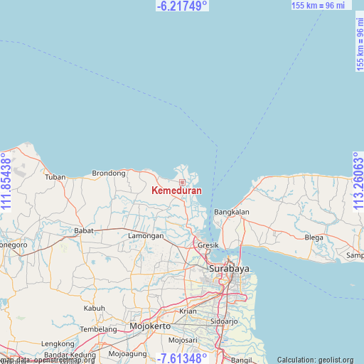
Kemeduran GPS coordinates[2]
6° 54' 57.6" South, 112° 33' 27" East
| Map corner | latitude | longitude |
|---|---|---|
| Upper-left | -6.21749°, | 111.85438° |
| Center: | -6.916°, | 112.5575° |
| Lower-right: | -7.61348°, | 113.26063° |
| Map W x H: | 155.2×155.2 km | = 96.4×96.4mi |
| max Lat: | 5.88969° ⇑28.4% North |
| Kemeduran: | -6.916° |
| min Lat: | ⇓71.6% South -10.934° |
| min Long | Kemeduran | max Long |
| 95.1345° | 112.5575° | 140.9419° |
| W 55.5%⇐ | ⇒44.5% E |
Elevation
Elevation of Kemeduran is 8 m = 26 ft, and this is 221.7 m = 727 ft below average elevation for this country.
| Max E: |
3185 m = 10449 ft | 93.7% |
| Avg. | 229.7 m = 754 ft | |
| Kemeduran | 8 m = 26 ft | |
Min E: |
-1 m = -3 ft | 6.3% |
See also: Indonesia elevation on elevation.city.
Geographical zone
Kemeduran is located in South Torrid zone (between Equator and Tropic of Capricorn). Distance of Equator is 769 km =477.8 mi to North.| Distance of | km | miles | from Kemeduran |
|---|---|---|---|
| Equator | 769 | 477.8 | to North |
| Tropic Capricorn | 1836.9 | 1141.4 | to South |
| Antarctic Circle | 6632.2 | 4121.1 | to South |
| South Pole | 9238.1 | 5740.3 | to South |


Nearby cities:
15 places around Kemeduran: (largest is in red/bold)
• Banyulegi
3 km =1.9 mi,  278°
278°
• Bolo
6.4 km =4 mi,  216°
216°
• Canga’an
5.7 km =3.5 mi,  263°
263°
• Glatik
6.5 km =4 mi,  198°
198°
• Golokan
7.2 km =4.5 mi, 196°
• Gosari
5.9 km =3.7 mi,  244°
244°
• Karangrejo
4 km =2.5 mi,  183°
183°
• Kebonagung
4.1 km =2.5 mi, 222°
• Ketapang
4.8 km =3 mi, 183°
• Krajan Pangkah Kulon
0.4 km =0.2 mi,  273°
273°
• Ngembo
6.2 km =3.9 mi, 277°
• Sambipondok
7.2 km =4.5 mi,  209°
209°
• Sekapuk
7.1 km =4.4 mi,  233°
233°
• Sidomulyo
5.8 km =3.6 mi,  186°
186°
• Ujungpangkah
0.3 km =0.2 mi,  247°
247°
Sources, notices
• [Note1] Compared only with cities in Indonesia existing in our database
• [Src1] Map data: © OpenStreetMap contributors (CC-BY-SA)
• [Src2] Other city data from geonames.org with taken over terms of usage.
• [Src3] Geographical zone / Annual Mean Temperature by Robert A. Rohde @ Wikipedia
