Ngulung Wetan geodata
Ngulung Wetan (East Java) is a seat of a fourth-order administrative division; located in Indonesia in Asia/Jakarta (GMT+7) time zone. In our database, there are 407 cities with bigger population. Compared to other cities in Indonesia, 76.4% of cities are located further ↑North; 58.2% of cities are located further →East and 61.4% of cities have lower elevation than Ngulung Wetan. Note1


Ngulung Wetan GPS coordinates[2]
8° 17' 34.08" South, 111° 29' 12.12" East
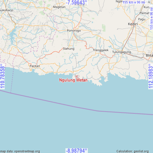
| Map corner | latitude | longitude |
|---|---|---|
| Upper-left | -7.59643°, | 110.78358° |
| Center: | -8.2928°, | 111.4867° |
| Lower-right: | -8.98794°, | 112.18983° |
| Map W x H: | 154.7×154.7 km | = 96.1×96.1mi |
| max Lat: | 5.88969° ⇑76.4% North |
| Ngulung Wetan: | -8.2928° |
| min Lat: | ⇓23.6% South -10.934° |
| min Long | Ngulung Wetan | max Long |
| 95.1345° | 111.4867° | 140.9419° |
| W 41.8%⇐ | ⇒58.2% E |
Elevation
Elevation of Ngulung Wetan is 179 m = 587 ft, and this is 50.7 m = 166 ft below average elevation for this country.
| Max E: |
3185 m = 10449 ft | 38.6% |
| Avg. | 229.7 m = 754 ft | |
| Ngulung Wetan | 179 m = 587 ft | |
Min E: |
-1 m = -3 ft | 61.4% |
See also: Indonesia elevation on elevation.city.
Geographical zone
Ngulung Wetan is located in South Torrid zone (between Equator and Tropic of Capricorn). Distance of Equator is 922.1 km =573 mi to North.| Distance of | km | miles | from Ngulung Wetan |
|---|---|---|---|
| Equator | 922.1 | 573 | to North |
| Tropic Capricorn | 1683.8 | 1046.3 | to South |
| Antarctic Circle | 6479.1 | 4025.9 | to South |
| South Pole | 9085 | 5645.2 | to South |


Nearby cities:
15 places around Ngulung Wetan: (largest is in red/bold)
• Banjar
2.9 km =1.8 mi,  345°
345°
• Barang
8.6 km =5.3 mi, 345°
• Gayam
7.5 km =4.7 mi,  328°
328°
• Kebonagung
7.2 km =4.5 mi, 332°
• Krajan Craken
6.3 km =3.9 mi,  93°
93°
• Krajan Ngrambingan
3.7 km =2.3 mi,  3°
3°
• Masaran
8.2 km =5.1 mi,  98°
98°
• Nglebeng
5.4 km =3.4 mi,  318°
318°
• Ngrencak
6.5 km =4 mi,  337°
337°
• Ngulung Kulon
2.6 km =1.6 mi,  120°
120°
• Pandean
8 km =5 mi,  41°
41°
• Panggul
5.9 km =3.7 mi, 324°
• Sobo
3 km =1.9 mi,  66°
66°
• Watuagung
5.7 km =3.5 mi, 36°
• Wonocoyo Utara
5.9 km =3.7 mi, 322°
Sources, notices
• [Note1] Compared only with cities in Indonesia existing in our database
• [Src1] Map data: © OpenStreetMap contributors (CC-BY-SA)
• [Src2] Other city data from geonames.org with taken over terms of usage.
• [Src3] Geographical zone / Annual Mean Temperature by Robert A. Rohde @ Wikipedia
