Gandekan geodata
Gandekan (East Java) is a seat of a fourth-order administrative division; located in Indonesia in Asia/Jakarta (GMT+7) time zone. In our database, there are 407 cities with bigger population. Compared to other cities in Indonesia, 64.8% of cities are located further ↑North; 50% of cities are located further ←West and 51.6% of cities have lower elevation than Gandekan. Note1


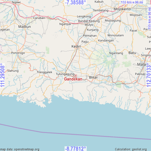
Gandekan GPS coordinates[2]
8° 4' 57.36" South, 111° 59' 53.52" East
| Map corner | latitude | longitude |
|---|---|---|
| Upper-left | -7.38588°, | 111.29508° |
| Center: | -8.0826°, | 111.9982° |
| Lower-right: | -8.77812°, | 112.70133° |
| Map W x H: | 154.8×154.8 km | = 96.2×96.2mi |
| max Lat: | 5.88969° ⇑64.8% North |
| Gandekan: | -8.0826° |
| min Lat: | ⇓35.2% South -10.934° |
| min Long | Gandekan | max Long |
| 95.1345° | 111.9982° | 140.9419° |
| W 50%⇐ | ⇒50% E |
Elevation
Elevation of Gandekan is 108 m = 354 ft, and this is 121.7 m = 399 ft below average elevation for this country.
| Max E: |
3185 m = 10449 ft | 48.4% |
| Avg. | 229.7 m = 754 ft | |
| Gandekan | 108 m = 354 ft | |
Min E: |
-1 m = -3 ft | 51.6% |
See also: Indonesia elevation on elevation.city.
Geographical zone
Gandekan is located in South Torrid zone (between Equator and Tropic of Capricorn). Distance of Equator is 898.7 km =558.4 mi to North.| Distance of | km | miles | from Gandekan |
|---|---|---|---|
| Equator | 898.7 | 558.4 | to North |
| Tropic Capricorn | 1707.2 | 1060.8 | to South |
| Antarctic Circle | 6502.5 | 4040.5 | to South |
| South Pole | 9108.4 | 5659.7 | to South |


Nearby cities:
15 places around Gandekan: (largest is in red/bold)
• Cangkringan
5.1 km =3.2 mi,  216°
216°
• Dukuh
3.8 km =2.4 mi, 219°
• Jabalan
3.5 km =2.2 mi,  270°
270°
• Kaliboto
4.8 km =3 mi,  335°
335°
• Kromasan
2.7 km =1.7 mi,  232°
232°
• Ngrukem
2.1 km =1.3 mi,  282°
282°
• Ngunut
3.2 km =2 mi,  142°
142°
• Pakel
1.9 km =1.2 mi,  327°
327°
• Pucung
4.3 km =2.7 mi,  320°
320°
• Pulosari
1.5 km =0.9 mi, 221°
• Sadeng
4.4 km =2.7 mi, 231°
• Sambirobyong
3.7 km =2.3 mi,  301°
301°
• Setonokalong
4.1 km =2.5 mi,  252°
252°
• Sumberingin Kulon
5 km =3.1 mi,  190°
190°
• Sumberjo Kulon
2.9 km =1.8 mi, 192°
Sources, notices
• [Note1] Compared only with cities in Indonesia existing in our database
• [Src1] Map data: © OpenStreetMap contributors (CC-BY-SA)
• [Src2] Other city data from geonames.org with taken over terms of usage.
• [Src3] Geographical zone / Annual Mean Temperature by Robert A. Rohde @ Wikipedia
