Jatirejo geodata
Jatirejo (East Java) is a seat of a fourth-order administrative division; located in Indonesia in Asia/Jakarta (GMT+7) time zone. In our database, there are 407 cities with bigger population. Compared to other cities in Indonesia, 67% of cities are located further ↑North; 54.5% of cities are located further →East and 51.6% of cities have lower elevation than Jatirejo. Note1


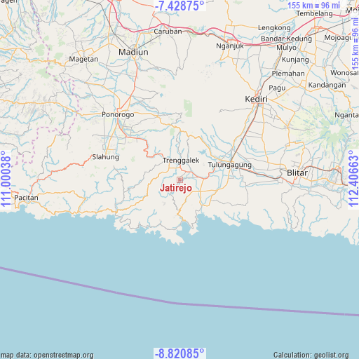
Jatirejo GPS coordinates[2]
8° 7' 31.44" South, 111° 42' 12.6" East
| Map corner | latitude | longitude |
|---|---|---|
| Upper-left | -7.42875°, | 111.00038° |
| Center: | -8.1254°, | 111.7035° |
| Lower-right: | -8.82085°, | 112.40663° |
| Map W x H: | 154.8×154.8 km | = 96.2×96.2mi |
| max Lat: | 5.88969° ⇑67% North |
| Jatirejo: | -8.1254° |
| min Lat: | ⇓33% South -10.934° |
| min Long | Jatirejo | max Long |
| 95.1345° | 111.7035° | 140.9419° |
| W 45.5%⇐ | ⇒54.5% E |
Elevation
Elevation of Jatirejo is 108 m = 354 ft, and this is 121.7 m = 399 ft below average elevation for this country.
| Max E: |
3185 m = 10449 ft | 48.4% |
| Avg. | 229.7 m = 754 ft | |
| Jatirejo | 108 m = 354 ft | |
Min E: |
-1 m = -3 ft | 51.6% |
See also: Indonesia elevation on elevation.city.
Geographical zone
Jatirejo is located in South Torrid zone (between Equator and Tropic of Capricorn). Distance of Equator is 903.5 km =561.4 mi to North.| Distance of | km | miles | from Jatirejo |
|---|---|---|---|
| Equator | 903.5 | 561.4 | to North |
| Tropic Capricorn | 1702.5 | 1057.9 | to South |
| Antarctic Circle | 6497.7 | 4037.5 | to South |
| South Pole | 9103.6 | 5656.7 | to South |


Nearby cities:
15 places around Jatirejo: (largest is in red/bold)
• Duwet
4.7 km =2.9 mi,  44°
44°
• Gandusari
0.5 km =0.3 mi,  168°
168°
• Jajarkrajan
3.2 km =2 mi,  176°
176°
• Jatiprahu
3.6 km =2.2 mi,  337°
337°
• Jedung
3 km =1.9 mi,  72°
72°
• Jugang
3.9 km =2.4 mi, 74°
• Manggis
1.8 km =1.1 mi,  25°
25°
• Pojok
4.6 km =2.9 mi,  210°
210°
• Sokobanteng
5 km =3.1 mi,  6°
6°
• Suko Wetan
3.1 km =1.9 mi,  302°
302°
• Sukorejo
1 km =0.6 mi, 206°
• Suwaru
4.9 km =3 mi, 67°
• Widoro
2 km =1.2 mi,  76°
76°
• Wonocoyo
3.3 km =2.1 mi, 37°
• Wonorejo
2.6 km =1.6 mi,  202°
202°
Sources, notices
• [Note1] Compared only with cities in Indonesia existing in our database
• [Src1] Map data: © OpenStreetMap contributors (CC-BY-SA)
• [Src2] Other city data from geonames.org with taken over terms of usage.
• [Src3] Geographical zone / Annual Mean Temperature by Robert A. Rohde @ Wikipedia
