Pojok geodata
Pojok (East Java) is a seat of a fourth-order administrative division; located in Indonesia in Asia/Jakarta (GMT+7) time zone. In our database, there are 407 cities with bigger population. Compared to other cities in Indonesia, 69.2% of cities are located further ↑North; 54.8% of cities are located further →East and 53.7% of cities have lower elevation than Pojok. Note1


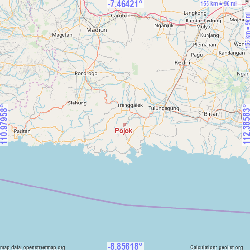
Pojok GPS coordinates[2]
8° 9' 38.88" South, 111° 40' 57.72" East
| Map corner | latitude | longitude |
|---|---|---|
| Upper-left | -7.46421°, | 110.97958° |
| Center: | -8.1608°, | 111.6827° |
| Lower-right: | -8.85618°, | 112.38583° |
| Map W x H: | 154.8×154.8 km | = 96.2×96.2mi |
| max Lat: | 5.88969° ⇑69.2% North |
| Pojok: | -8.1608° |
| min Lat: | ⇓30.8% South -10.934° |
| min Long | Pojok | max Long |
| 95.1345° | 111.6827° | 140.9419° |
| W 45.2%⇐ | ⇒54.8% E |
Elevation
Elevation of Pojok is 118 m = 387 ft, and this is 111.7 m = 366 ft below average elevation for this country.
| Max E: |
3185 m = 10449 ft | 46.3% |
| Avg. | 229.7 m = 754 ft | |
| Pojok | 118 m = 387 ft | |
Min E: |
-1 m = -3 ft | 53.7% |
See also: Indonesia elevation on elevation.city.
Geographical zone
Pojok is located in South Torrid zone (between Equator and Tropic of Capricorn). Distance of Equator is 907.4 km =563.8 mi to North.| Distance of | km | miles | from Pojok |
|---|---|---|---|
| Equator | 907.4 | 563.8 | to North |
| Tropic Capricorn | 1698.5 | 1055.4 | to South |
| Antarctic Circle | 6493.8 | 4035.1 | to South |
| South Pole | 9099.7 | 5654.3 | to South |


Nearby cities:
15 places around Pojok: (largest is in red/bold)
• Bogoran
3.3 km =2.1 mi,  225°
225°
• Gandusari
4.2 km =2.6 mi,  34°
34°
• Gelatik
5.5 km =3.4 mi,  177°
177°
• Jajarkrajan
2.6 km =1.6 mi,  72°
72°
• Jatirejo
4.6 km =2.9 mi, 30°
• Kademangan
2.7 km =1.7 mi,  217°
217°
• Kampak
2.8 km =1.7 mi,  236°
236°
• Karangrejokrajan
4.3 km =2.7 mi, 217°
• Ngembel
3.8 km =2.4 mi,  151°
151°
• Senden
2.9 km =1.8 mi,  198°
198°
• Sukorejo
3.6 km =2.2 mi, 31°
• Timahankrajan
3.4 km =2.1 mi,  292°
292°
• Wates
0.7 km =0.4 mi,  249°
249°
• Watuagung
5.4 km =3.4 mi,  137°
137°
• Wonorejo
2 km =1.2 mi,  40°
40°
Sources, notices
• [Note1] Compared only with cities in Indonesia existing in our database
• [Src1] Map data: © OpenStreetMap contributors (CC-BY-SA)
• [Src2] Other city data from geonames.org with taken over terms of usage.
• [Src3] Geographical zone / Annual Mean Temperature by Robert A. Rohde @ Wikipedia
