Senden geodata
Senden (East Java) is a seat of a fourth-order administrative division; located in Indonesia in Asia/Jakarta (GMT+7) time zone. In our database, there are 407 cities with bigger population. Compared to other cities in Indonesia, 70.7% of cities are located further ↑North; 54.9% of cities are located further →East and 54.8% of cities have lower elevation than Senden. Note1


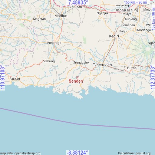
Senden GPS coordinates[2]
8° 11' 9.24" South, 111° 40' 27.12" East
| Map corner | latitude | longitude |
|---|---|---|
| Upper-left | -7.48935°, | 110.97108° |
| Center: | -8.1859°, | 111.6742° |
| Lower-right: | -8.88124°, | 112.37733° |
| Map W x H: | 154.8×154.8 km | = 96.2×96.2mi |
| max Lat: | 5.88969° ⇑70.7% North |
| Senden: | -8.1859° |
| min Lat: | ⇓29.3% South -10.934° |
| min Long | Senden | max Long |
| 95.1345° | 111.6742° | 140.9419° |
| W 45.1%⇐ | ⇒54.9% E |
Elevation
Elevation of Senden is 124 m = 407 ft, and this is 105.7 m = 347 ft below average elevation for this country.
| Max E: |
3185 m = 10449 ft | 45.2% |
| Avg. | 229.7 m = 754 ft | |
| Senden | 124 m = 407 ft | |
Min E: |
-1 m = -3 ft | 54.8% |
See also: Indonesia elevation on elevation.city.
Geographical zone
Senden is located in South Torrid zone (between Equator and Tropic of Capricorn). Distance of Equator is 910.2 km =565.6 mi to North.| Distance of | km | miles | from Senden |
|---|---|---|---|
| Equator | 910.2 | 565.6 | to North |
| Tropic Capricorn | 1695.7 | 1053.7 | to South |
| Antarctic Circle | 6491 | 4033.3 | to South |
| South Pole | 9096.9 | 5652.5 | to South |


Nearby cities:
15 places around Senden: (largest is in red/bold)
• Bogoran
1.5 km =0.9 mi,  287°
287°
• Gelatik
2.9 km =1.8 mi,  156°
156°
• Jajarkrajan
4.9 km =3 mi,  43°
43°
• Kademangan
1 km =0.6 mi,  312°
312°
• Kampak
1.9 km =1.2 mi, 311°
• Karangrejokrajan
1.8 km =1.1 mi,  248°
248°
• Ngembel
2.8 km =1.7 mi,  101°
101°
• Pojok
2.9 km =1.8 mi,  18°
18°
• Ponggok
5.9 km =3.7 mi,  166°
166°
• Tanjung
4.1 km =2.5 mi, 248°
• Timahankrajan
4.7 km =2.9 mi,  331°
331°
• Wates
2.6 km =1.6 mi,  7°
7°
• Watuagung
4.7 km =2.9 mi, 104°
• Watulimo
6 km =3.7 mi,  130°
130°
• Wonorejo
4.9 km =3 mi,  27°
27°
Sources, notices
• [Note1] Compared only with cities in Indonesia existing in our database
• [Src1] Map data: © OpenStreetMap contributors (CC-BY-SA)
• [Src2] Other city data from geonames.org with taken over terms of usage.
• [Src3] Geographical zone / Annual Mean Temperature by Robert A. Rohde @ Wikipedia
