Tawang geodata
Tawang (East Java) is a seat of a fourth-order administrative division; located in Indonesia in Asia/Jakarta (GMT+7) time zone. In our database, there are 407 cities with bigger population. Compared to other cities in Indonesia, 66.4% of cities are located further ↑North; 56.1% of cities are located further →East and 80.3% of cities have lower elevation than Tawang. Note1


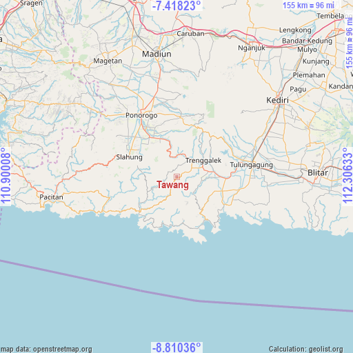
Tawang GPS coordinates[2]
8° 6' 53.64" South, 111° 36' 11.52" East
| Map corner | latitude | longitude |
|---|---|---|
| Upper-left | -7.41823°, | 110.90008° |
| Center: | -8.1149°, | 111.6032° |
| Lower-right: | -8.81036°, | 112.30633° |
| Map W x H: | 154.8×154.8 km | = 96.2×96.2mi |
| max Lat: | 5.88969° ⇑66.4% North |
| Tawang: | -8.1149° |
| min Lat: | ⇓33.6% South -10.934° |
| min Long | Tawang | max Long |
| 95.1345° | 111.6032° | 140.9419° |
| W 43.9%⇐ | ⇒56.1% E |
Elevation
Elevation of Tawang is 437 m = 1434 ft, and this is 207.3 m = 680 ft above average elevation for this country.
| Max E: |
3185 m = 10449 ft | 19.7% |
| Tawang | 437 m 1434 ft | |
| Avg. | 229.7 m = 754 ft | |
Min E: |
-1 m = -3 ft | 80.3% |
See also: Indonesia elevation on elevation.city.
Geographical zone
Tawang is located in South Torrid zone (between Equator and Tropic of Capricorn). Distance of Equator is 902.3 km =560.7 mi to North.| Distance of | km | miles | from Tawang |
|---|---|---|---|
| Equator | 902.3 | 560.7 | to North |
| Tropic Capricorn | 1703.6 | 1058.6 | to South |
| Antarctic Circle | 6498.9 | 4038.2 | to South |
| South Pole | 9104.8 | 5657.5 | to South |


Nearby cities:
15 places around Tawang: (largest is in red/bold)
• Crabak
3 km =1.9 mi,  157°
157°
• Gandu
2.8 km =1.7 mi,  0°
0°
• Jati
5.7 km =3.5 mi,  68°
68°
• Jatirejo
3.8 km =2.4 mi,  57°
57°
• Krajan Karanganyar
5.8 km =3.6 mi,  307°
307°
• Krajan Puru
1.4 km =0.9 mi,  209°
209°
• Krajan Suko Kidul
6.6 km =4.1 mi,  336°
336°
• Krajan Tenggaran
6.5 km =4 mi,  295°
295°
• Krayen
5.3 km =3.3 mi,  54°
54°
• Mloko
6.6 km =4.1 mi,  204°
204°
• Pule
4.7 km =2.9 mi,  257°
257°
• Sidem
3 km =1.9 mi, 312°
• Soho
5.5 km =3.4 mi,  89°
89°
• Timahankrajan
6.7 km =4.2 mi,  123°
123°
• Wonokerto
0.9 km =0.6 mi,  194°
194°
Sources, notices
• [Note1] Compared only with cities in Indonesia existing in our database
• [Src1] Map data: © OpenStreetMap contributors (CC-BY-SA)
• [Src2] Other city data from geonames.org with taken over terms of usage.
• [Src3] Geographical zone / Annual Mean Temperature by Robert A. Rohde @ Wikipedia
