Randu geodata
Randu (East Java) is a seat of a fourth-order administrative division; located in Indonesia in Asia/Jakarta (GMT+7) time zone. In our database, there are 407 cities with bigger population. Compared to other cities in Indonesia, 66.7% of cities are located further ↑North; 53% of cities are located further →East and 51.7% of cities have higher elevation than Randu. Note1


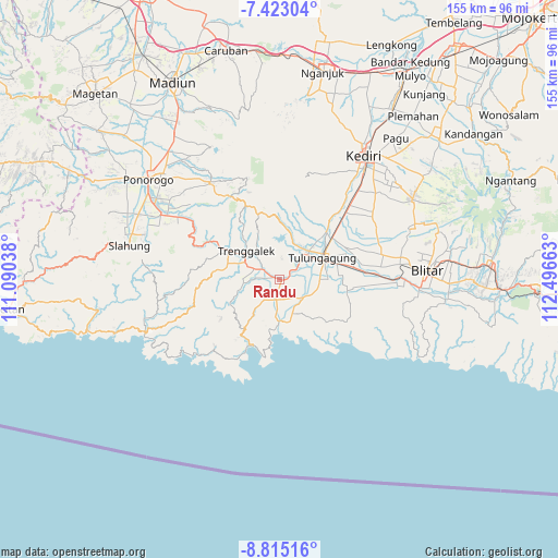
Randu GPS coordinates[2]
8° 7' 10.92" South, 111° 47' 36.6" East
| Map corner | latitude | longitude |
|---|---|---|
| Upper-left | -7.42304°, | 111.09038° |
| Center: | -8.1197°, | 111.7935° |
| Lower-right: | -8.81516°, | 112.49663° |
| Map W x H: | 154.8×154.8 km | = 96.2×96.2mi |
| max Lat: | 5.88969° ⇑66.7% North |
| Randu: | -8.1197° |
| min Lat: | ⇓33.3% South -10.934° |
| min Long | Randu | max Long |
| 95.1345° | 111.7935° | 140.9419° |
| W 47%⇐ | ⇒53% E |
Elevation
Elevation of Randu is 96 m = 315 ft, and this is 133.7 m = 439 ft below average elevation for this country.
| Max E: |
3185 m = 10449 ft | 51.7% |
| Avg. | 229.7 m = 754 ft | |
| Randu | 96 m = 315 ft | |
Min E: |
-1 m = -3 ft | 48.3% |
See also: Indonesia elevation on elevation.city.
Geographical zone
Randu is located in South Torrid zone (between Equator and Tropic of Capricorn). Distance of Equator is 902.8 km =561 mi to North.| Distance of | km | miles | from Randu |
|---|---|---|---|
| Equator | 902.8 | 561 | to North |
| Tropic Capricorn | 1703.1 | 1058.3 | to South |
| Antarctic Circle | 6498.3 | 4037.9 | to South |
| South Pole | 9104.2 | 5657.1 | to South |


Nearby cities:
15 places around Randu: (largest is in red/bold)
• Brongkah
2 km =1.2 mi,  288°
288°
• Bulus
3 km =1.9 mi,  205°
205°
• Cangkringan
1.4 km =0.9 mi,  18°
18°
• Durenan
0.6 km =0.4 mi,  96°
96°
• Gambang
3 km =1.9 mi,  235°
235°
• Gandong
2.5 km =1.6 mi,  183°
183°
• Jajar
3.1 km =1.9 mi,  67°
67°
• Pakis
1.4 km =0.9 mi, 67°
• Pandean
1.6 km =1 mi,  89°
89°
• Payaman
1.5 km =0.9 mi,  107°
107°
• Sanggar
3.2 km =2 mi,  220°
220°
• Sendangkemulian
3.5 km =2.2 mi,  45°
45°
• Suwaluh
3.1 km =1.9 mi,  134°
134°
• Telan
1.3 km =0.8 mi,  169°
169°
• Tertek
2.4 km =1.5 mi, 97°
Sources, notices
• [Note1] Compared only with cities in Indonesia existing in our database
• [Src1] Map data: © OpenStreetMap contributors (CC-BY-SA)
• [Src2] Other city data from geonames.org with taken over terms of usage.
• [Src3] Geographical zone / Annual Mean Temperature by Robert A. Rohde @ Wikipedia
