Brongkah geodata
Brongkah (East Java) is a seat of a fourth-order administrative division; located in Indonesia in Asia/Jakarta (GMT+7) time zone. In our database, there are 407 cities with bigger population. Compared to other cities in Indonesia, 66.3% of cities are located further ↑North; 53.3% of cities are located further →East and 51.1% of cities have higher elevation than Brongkah. Note1


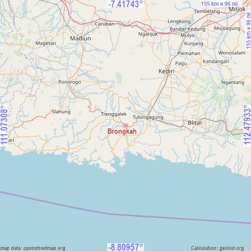
Brongkah GPS coordinates[2]
8° 6' 50.76" South, 111° 46' 34.32" East
| Map corner | latitude | longitude |
|---|---|---|
| Upper-left | -7.41743°, | 111.07308° |
| Center: | -8.1141°, | 111.7762° |
| Lower-right: | -8.80957°, | 112.47933° |
| Map W x H: | 154.8×154.8 km | = 96.2×96.2mi |
| max Lat: | 5.88969° ⇑66.3% North |
| Brongkah: | -8.1141° |
| min Lat: | ⇓33.7% South -10.934° |
| min Long | Brongkah | max Long |
| 95.1345° | 111.7762° | 140.9419° |
| W 46.7%⇐ | ⇒53.3% E |
Elevation
Elevation of Brongkah is 98 m = 322 ft, and this is 131.7 m = 432 ft below average elevation for this country.
| Max E: |
3185 m = 10449 ft | 51.1% |
| Avg. | 229.7 m = 754 ft | |
| Brongkah | 98 m = 322 ft | |
Min E: |
-1 m = -3 ft | 48.9% |
See also: Indonesia elevation on elevation.city.
Geographical zone
Brongkah is located in South Torrid zone (between Equator and Tropic of Capricorn). Distance of Equator is 902.2 km =560.6 mi to North.| Distance of | km | miles | from Brongkah |
|---|---|---|---|
| Equator | 902.2 | 560.6 | to North |
| Tropic Capricorn | 1703.7 | 1058.6 | to South |
| Antarctic Circle | 6499 | 4038.3 | to South |
| South Pole | 9104.9 | 5657.5 | to South |


Nearby cities:
15 places around Brongkah: (largest is in red/bold)
• Bulus
3.4 km =2.1 mi,  169°
169°
• Cangkringan
2.5 km =1.6 mi,  72°
72°
• Durenan
2.6 km =1.6 mi,  105°
105°
• Gambang
2.4 km =1.5 mi,  194°
194°
• Gandong
3.6 km =2.2 mi,  150°
150°
• Jugang
4.2 km =2.6 mi,  266°
266°
• Jungke
2.5 km =1.6 mi,  261°
261°
• Pakis
3.2 km =2 mi,  91°
91°
• Pandean
3.5 km =2.2 mi,  100°
100°
• Payaman
3.5 km =2.2 mi, 107°
• Randu
2 km =1.2 mi, 108°
• Sanggar
3.1 km =1.9 mi,  184°
184°
• Soko
3.2 km =2 mi, 192°
• Suwaru
3.5 km =2.2 mi,  280°
280°
• Telan
2.9 km =1.8 mi,  132°
132°
Sources, notices
• [Note1] Compared only with cities in Indonesia existing in our database
• [Src1] Map data: © OpenStreetMap contributors (CC-BY-SA)
• [Src2] Other city data from geonames.org with taken over terms of usage.
• [Src3] Geographical zone / Annual Mean Temperature by Robert A. Rohde @ Wikipedia
