Temorlorong geodata
Temorlorong (East Java) is a seat of a fourth-order administrative division; located in Indonesia in Asia/Jakarta (GMT+7) time zone. In our database, there are 407 cities with bigger population. Compared to other cities in Indonesia, 58.4% of cities are located further ↓South; 62.4% of cities are located further ←West and 63.2% of cities have higher elevation than Temorlorong. Note1


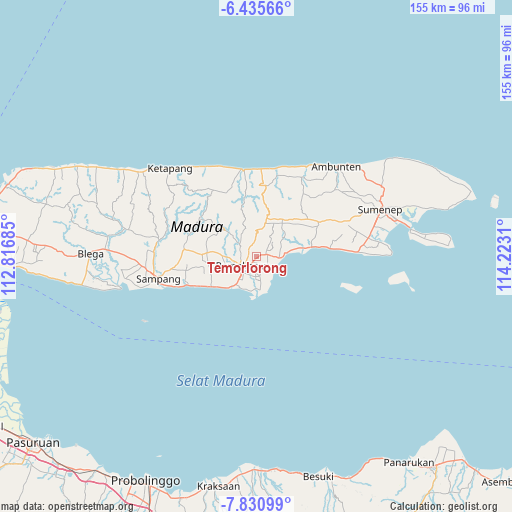
Temorlorong GPS coordinates[2]
7° 8' 1.896" South, 113° 31' 11.892" East
| Map corner | latitude | longitude |
|---|---|---|
| Upper-left | -6.43566°, | 112.81685° |
| Center: | -7.13386°, | 113.51997° |
| Lower-right: | -7.83099°, | 114.2231° |
| Map W x H: | 155.1×155.1 km | = 96.4×96.4mi |
| max Lat: | 5.88969° ⇑41.6% North |
| Temorlorong: | -7.13386° |
| min Lat: | ⇓58.4% South -10.934° |
| min Long | Temorlorong | max Long |
| 95.1345° | 113.51997° | 140.9419° |
| W 62.4%⇐ | ⇒37.6% E |
Elevation
Elevation of Temorlorong is 48 m = 157 ft, and this is 181.7 m = 596 ft below average elevation for this country.
| Max E: |
3185 m = 10449 ft | 63.2% |
| Avg. | 229.7 m = 754 ft | |
| Temorlorong | 48 m = 157 ft | |
Min E: |
-1 m = -3 ft | 36.8% |
See also: Indonesia elevation on elevation.city.
Geographical zone
Temorlorong is located in South Torrid zone (between Equator and Tropic of Capricorn). Distance of Equator is 793.2 km =492.9 mi to North.| Distance of | km | miles | from Temorlorong |
|---|---|---|---|
| Equator | 793.2 | 492.9 | to North |
| Tropic Capricorn | 1812.7 | 1126.4 | to South |
| Antarctic Circle | 6608 | 4106 | to South |
| South Pole | 9213.9 | 5725.3 | to South |


Nearby cities:
15 places around Temorlorong: (largest is in red/bold)
• Barajalan
1.6 km =1 mi,  87°
87°
• Biris Daja
2.2 km =1.4 mi,  180°
180°
• Bulay
3.3 km =2.1 mi,  107°
107°
• Bulung
2.9 km =1.8 mi,  201°
201°
• Duwaktenggi
2.7 km =1.7 mi,  15°
15°
• Grujugan
2.1 km =1.3 mi,  71°
71°
• Larangan
3 km =1.9 mi,  79°
79°
• Lobuk
2.8 km =1.7 mi, 182°
• Ombul
3.1 km =1.9 mi,  232°
232°
• Pancoran
3.4 km =2.1 mi,  0°
0°
• Rongrongan
2.1 km =1.3 mi,  153°
153°
• Tandes
3.5 km =2.2 mi,  139°
139°
• Tentenan
1.5 km =0.9 mi, 75°
• Toampar
2.5 km =1.6 mi, 82°
• Trasak
0.4 km =0.2 mi, 66°
Sources, notices
• [Note1] Compared only with cities in Indonesia existing in our database
• [Src1] Map data: © OpenStreetMap contributors (CC-BY-SA)
• [Src2] Other city data from geonames.org with taken over terms of usage.
• [Src3] Geographical zone / Annual Mean Temperature by Robert A. Rohde @ Wikipedia
