Grujugan geodata
Grujugan (East Java) is a seat of a fourth-order administrative division; located in Indonesia in Asia/Jakarta (GMT+7) time zone. In our database, there are 407 cities with bigger population. Compared to other cities in Indonesia, 64.1% of cities are located further ↓South; 63.6% of cities are located further ←West and 62.8% of cities have lower elevation than Grujugan. Note1


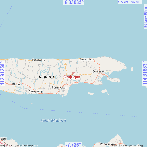
Grujugan GPS coordinates[2]
7° 1' 43.32" South, 113° 36' 56.52" East
| Map corner | latitude | longitude |
|---|---|---|
| Upper-left | -6.33035°, | 112.91258° |
| Center: | -7.0287°, | 113.6157° |
| Lower-right: | -7.726°, | 114.31883° |
| Map W x H: | 155.2×155.2 km | = 96.4×96.4mi |
| max Lat: | 5.88969° ⇑35.9% North |
| Grujugan: | -7.0287° |
| min Lat: | ⇓64.1% South -10.934° |
| min Long | Grujugan | max Long |
| 95.1345° | 113.6157° | 140.9419° |
| W 63.6%⇐ | ⇒36.4% E |
Elevation
Elevation of Grujugan is 195 m = 640 ft, and this is 34.7 m = 114 ft below average elevation for this country.
| Max E: |
3185 m = 10449 ft | 37.2% |
| Avg. | 229.7 m = 754 ft | |
| Grujugan | 195 m = 640 ft | |
Min E: |
-1 m = -3 ft | 62.8% |
See also: Indonesia elevation on elevation.city.
Geographical zone
Grujugan is located in South Torrid zone (between Equator and Tropic of Capricorn). Distance of Equator is 781.5 km =485.6 mi to North.| Distance of | km | miles | from Grujugan |
|---|---|---|---|
| Equator | 781.5 | 485.6 | to North |
| Tropic Capricorn | 1824.4 | 1133.6 | to South |
| Antarctic Circle | 6619.7 | 4113.3 | to South |
| South Pole | 9225.5 | 5732.5 | to South |


Nearby cities:
15 places around Grujugan: (largest is in red/bold)
• Bangrat
3 km =1.9 mi,  116°
116°
• Banlapa
4.9 km =3 mi,  95°
95°
• Ba’rigi
1.9 km =1.2 mi,  228°
228°
• Birsa
1.9 km =1.2 mi,  179°
179°
• Gunung
4 km =2.5 mi,  292°
292°
• Kendal
3.5 km =2.2 mi,  242°
242°
• Masaran
2.7 km =1.7 mi,  153°
153°
• Masaran
5.2 km =3.2 mi,  333°
333°
• Nangger
1.9 km =1.2 mi, 103°
• Palalang
4.7 km =2.9 mi,  264°
264°
• Parengan Laok
2.7 km =1.7 mi, 259°
• Polay Atas
4.7 km =2.9 mi,  207°
207°
• Pordapor Barat
3.3 km =2.1 mi,  137°
137°
• Sannip
4.1 km =2.5 mi, 238°
• Sumberaya Barat
3 km =1.9 mi, 237°
Sources, notices
• [Note1] Compared only with cities in Indonesia existing in our database
• [Src1] Map data: © OpenStreetMap contributors (CC-BY-SA)
• [Src2] Other city data from geonames.org with taken over terms of usage.
• [Src3] Geographical zone / Annual Mean Temperature by Robert A. Rohde @ Wikipedia
