Bogi geodata
Bogi (East Nusa Tenggara) is a seat of a fourth-order administrative division; located in Indonesia in Asia/Makassar (GMT+8) time zone. In our database, there are 407 cities with bigger population. Compared to other cities in Indonesia, 99.3% of cities are located further ↑North; 86.7% of cities are located further ←West and 59.4% of cities have lower elevation than Bogi. Note1


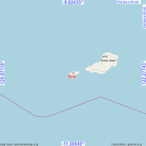
Bogi GPS coordinates[2]
10° 36' 58.32" South, 121° 34' 27.48" East
| Map corner | latitude | longitude |
|---|---|---|
| Upper-left | -9.92435°, | 120.87118° |
| Center: | -10.6162°, | 121.5743° |
| Lower-right: | -11.30649°, | 122.27743° |
| Map W x H: | 153.7×153.7 km | = 95.5×95.5mi |
| max Lat: | 5.88969° ⇑99.3% North |
| Bogi: | -10.6162° |
| min Lat: | ⇓0.7% South -10.934° |
| min Long | Bogi | max Long |
| 95.1345° | 121.5743° | 140.9419° |
| W 86.7%⇐ | ⇒13.3% E |
Elevation
Elevation of Bogi is 157 m = 515 ft, and this is 72.7 m = 239 ft below average elevation for this country.
| Max E: |
3185 m = 10449 ft | 40.6% |
| Avg. | 229.7 m = 754 ft | |
| Bogi | 157 m = 515 ft | |
Min E: |
-1 m = -3 ft | 59.4% |
See also: Indonesia elevation on elevation.city.
Geographical zone
Bogi is located in South Torrid zone (between Equator and Tropic of Capricorn). Distance of Equator is 1180.4 km =733.5 mi to North.| Distance of | km | miles | from Bogi |
|---|---|---|---|
| Equator | 1180.4 | 733.5 | to North |
| Tropic Capricorn | 1425.5 | 885.8 | to South |
| Antarctic Circle | 6220.8 | 3865.4 | to South |
| South Pole | 8826.7 | 5484.7 | to South |


Nearby cities:
15 places around Bogi: (largest is in red/bold)
• Aimadamodo
25.6 km =15.9 mi,  81°
81°
• Danirai
18.6 km =11.6 mi, 75°
• Gelanalalu
22.9 km =14.2 mi,  86°
86°
• Lederaba
16.8 km =10.4 mi,  73°
73°
• Ledeunu
4.1 km =2.5 mi, 73°
• Lenakapa
19.9 km =12.4 mi, 85°
• Ligu
21.6 km =13.4 mi, 67°
• Loboma
0.6 km =0.4 mi,  173°
173°
• Lupe
2.3 km =1.4 mi,  268°
268°
• Maae
2.7 km =1.7 mi,  95°
95°
• Para
17.2 km =10.7 mi, 82°
• Pudi
20.2 km =12.6 mi, 81°
• Raenalulu
26.8 km =16.7 mi, 76°
• Ubajami
25.9 km =16.1 mi, 65°
• Ujudima
3.9 km =2.4 mi, 75°
Sources, notices
• [Note1] Compared only with cities in Indonesia existing in our database
• [Src1] Map data: © OpenStreetMap contributors (CC-BY-SA)
• [Src2] Other city data from geonames.org with taken over terms of usage.
• [Src3] Geographical zone / Annual Mean Temperature by Robert A. Rohde @ Wikipedia
