Sebuh geodata
Sebuh (East Java) is a seat of a fourth-order administrative division; located in Indonesia in Asia/Jakarta (GMT+7) time zone. In our database, there are 407 cities with bigger population. Compared to other cities in Indonesia, 71.3% of cities are located further ↓South; 58.3% of cities are located further ←West and 75.5% of cities have higher elevation than Sebuh. Note1


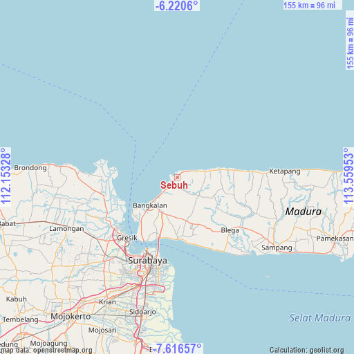
Sebuh GPS coordinates[2]
6° 55' 8.76" South, 112° 51' 23.04" East
| Map corner | latitude | longitude |
|---|---|---|
| Upper-left | -6.2206°, | 112.15328° |
| Center: | -6.9191°, | 112.8564° |
| Lower-right: | -7.61657°, | 113.55953° |
| Map W x H: | 155.2×155.2 km | = 96.4×96.4mi |
| max Lat: | 5.88969° ⇑28.7% North |
| Sebuh: | -6.9191° |
| min Lat: | ⇓71.3% South -10.934° |
| min Long | Sebuh | max Long |
| 95.1345° | 112.8564° | 140.9419° |
| W 58.3%⇐ | ⇒41.7% E |
Elevation
Elevation of Sebuh is 24 m = 79 ft, and this is 205.7 m = 675 ft below average elevation for this country.
| Max E: |
3185 m = 10449 ft | 75.5% |
| Avg. | 229.7 m = 754 ft | |
| Sebuh | 24 m = 79 ft | |
Min E: |
-1 m = -3 ft | 24.5% |
See also: Indonesia elevation on elevation.city.
Geographical zone
Sebuh is located in South Torrid zone (between Equator and Tropic of Capricorn). Distance of Equator is 769.3 km =478 mi to North.| Distance of | km | miles | from Sebuh |
|---|---|---|---|
| Equator | 769.3 | 478 | to North |
| Tropic Capricorn | 1836.6 | 1141.2 | to South |
| Antarctic Circle | 6631.8 | 4120.8 | to South |
| South Pole | 9237.7 | 5740 | to South |


Nearby cities:
15 places around Sebuh: (largest is in red/bold)
• Ambat
3.5 km =2.2 mi,  97°
97°
• Arosbaya
3.4 km =2.1 mi,  214°
214°
• Gintongan
1.5 km =0.9 mi,  39°
39°
• Kandang
2.9 km =1.8 mi,  120°
120°
• Karangasem Laok
2 km =1.2 mi,  157°
157°
• Kool Tengah
1.3 km =0.8 mi,  268°
268°
• Lebak Timur
3.1 km =1.9 mi,  220°
220°
• Makan
3.3 km =2.1 mi,  177°
177°
• Moarah Barat
2.5 km =1.6 mi, 223°
• Polongan Daja
2.6 km =1.6 mi, 158°
• Raas
1.5 km =0.9 mi,  228°
228°
• Rojing
3.2 km =2 mi,  66°
66°
• Ta’anyar
3.7 km =2.3 mi,  201°
201°
• Tolbuk Laok
2.1 km =1.3 mi,  247°
247°
• Trogan Barat
0.7 km =0.4 mi,  137°
137°
Sources, notices
• [Note1] Compared only with cities in Indonesia existing in our database
• [Src1] Map data: © OpenStreetMap contributors (CC-BY-SA)
• [Src2] Other city data from geonames.org with taken over terms of usage.
• [Src3] Geographical zone / Annual Mean Temperature by Robert A. Rohde @ Wikipedia
